Police Helicopter to Salfords, Kings Mill Lane
Wednesday, 18 March 2026 | 20:40 | From Eastbourne
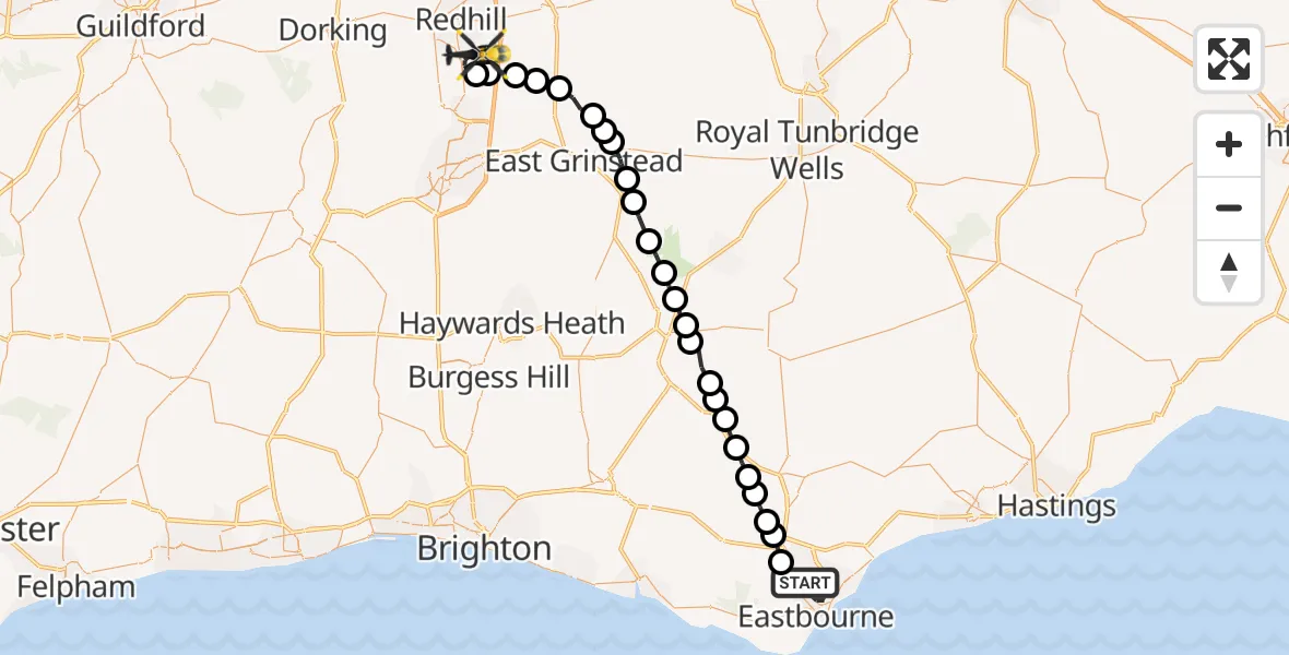
On Wednesday, 18 March 2026 at 20:40, a Police Helicopter departed from Eastbourne to Salfords. It was the Police Helicopter with registration number G-POLH. The flight lasted 22 minutes. During that period, the aircraft travelled 45 miles at an average speed of 122 miles per hour at a maximum altitude of 1300 feet.
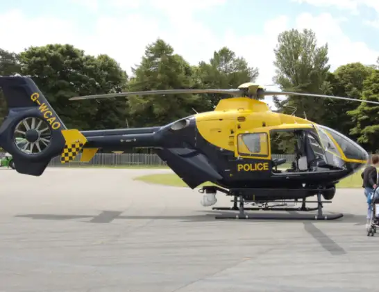
Helicopter: G-POLH
The helicopter G-POLH is used by the British police. The helicopter is deployed in pursuits, missing persons cases and other incidents where a helicopter provides added value.
Photo: Arpingstone
46 miles
1300 feet
122 mph
23 minutes
20:40
21:02

Route
Kings Mill Lane, Reigate and Banstead21:02
Salfords, Reigate and Banstead21:00
Tandridge, Tandridge21:00
Outwood, Outwood20:59
Tandridge, Tandridge20:59
Blindley Heath, Blindley Heath20:58
Lingfield, Lingfield20:57
Dormansland, Dormansland20:57
Tandridge, Tandridge20:56
Wealden, Wealden20:56
Forest Row, Wealden20:55
Wealden, Wealden20:54
Nutley, Wealden20:53
Fairwarp, Wealden20:53
Five Ash Down, Wealden20:52
Buxted, Wealden20:52
Framfield, Wealden20:51
Blackboys, Wealden20:50
East Hoathly, Wealden20:50
Whitesmith, Wealden20:49
Golden Cross, Wealden20:49
Upper Dicker, Wealden20:48
Arlington, Wealden20:48
Wealden, Wealden20:47
Wannock, Wealden20:47
Willingdon Park Drive, Eastbourne20:40
Today
Flights Salfords
Air Ambulance Helicopter to Redhill Aerodrome11 Jul 14:04
Police Helicopter to North Weald Bassett28 Jun 14:38
Air Ambulance Helicopter to Redhill Aerodrome10 Jun 09:33
Police Helicopter to Aldenham, Wards Lane8 Jun 08:55
Police Helicopter to South Nutfield, M236 Jun 19:01
Police Helicopter to Redhill Aerodrome6 Jun 00:03
Police Helicopter to Fishbourne, Westgate4 Jun 11:45
Flights Eastbourne
Coastguard Helicopter to Manston Airport10 Jul 15:15
Coastguard Helicopter to Brighton City Airport10 Jul 14:13
Coastguard Helicopter to English Channel10 Jul 13:49
Coastguard Helicopter to English Channel10 Jul 13:31
Helicopter flights on your website?
You can easily display helicopter flights on your own website. Use the embed code.
