Coastguard Helicopter to Solent Airport
Wednesday, 18 March 2026 | 20:32 | From Niton
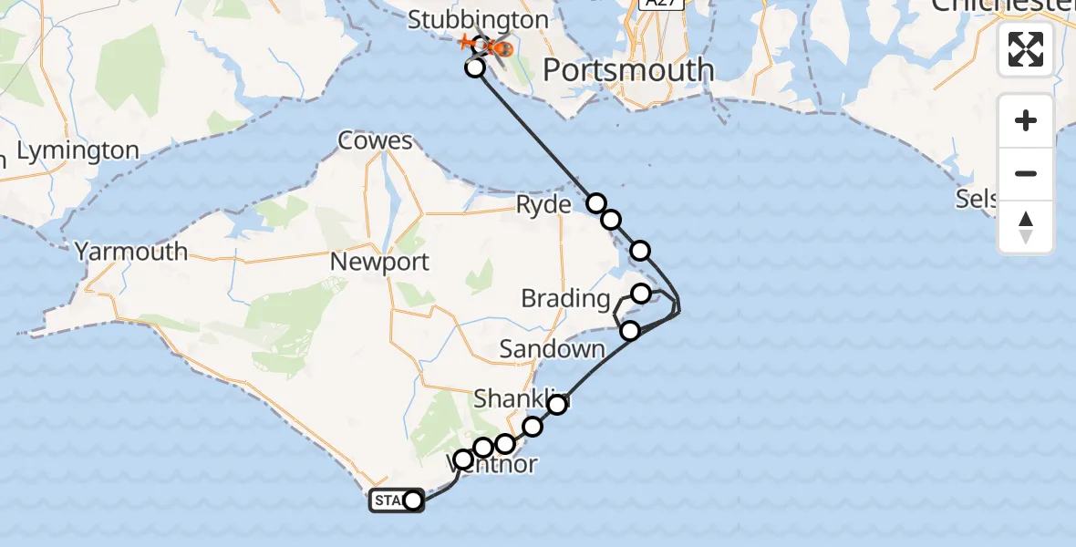
On Wednesday, 18 March 2026 at 20:32, a Coastguard Helicopter departed from Niton to Solent Airport. It was the Coastguard Helicopter with registration number G-RESF. The flight lasted 39 minutes. During that period, the aircraft travelled 31 miles at an average speed of 49 miles per hour at a maximum altitude of 975 feet.

Helicopter: G-RESF
The helicopter G-RESF is used by the British Coastguard. The helicopter is deployed in search and rescue operations at sea, rescue operations involving ships or drilling platforms, patrols to prevent smuggling or piracy, environmental monitoring and disaster relief support.
Photo: Tony Melony
32 miles
975 feet
49 mph
40 minutes
20:32
21:11

Route
Solent Airport, Gosport, Hampshire21:11
Solent Airport, Gosport, Hampshire21:11
Solent Airport, Gosport, Hampshire21:10
Stubbington, Stubbington21:09
English Channel21:07
Seaview, Seaview21:07
Bembridge, Bembridge21:06
English Channel, 21:05
English Channel20:55
Howgate Road, Bembridge20:54
English Channel20:50
Luccombe, Shanklin20:49
Bonchurch Road, Shanklin20:48
Bonchurch Road, Shanklin20:47
Bonchurch Road, Shanklin20:45
Shanklin, Shanklin20:43
Wroxall, Wroxall20:37
Ventnor, Ventnor20:36
Undercliff Drive, Ventnor20:34
St. Lawrence, Ventnor20:33
Niton, Niton20:32
Live flights
Air Ambulance Helicopter on its way from Ashford14 Jul 23:46
Coastguard Helicopter on its way from North Sea14 Jul 23:44
Today
Police Helicopter to Johnstone, Gordon Square14 Jul 23:38
Coastguard Helicopter to North Sea14 Jul 23:30
Police Helicopter to Inner Seas14 Jul 23:12
Air Ambulance Helicopter to Norwich Airport14 Jul 22:52
Police Helicopter to Manchester Barton Aerodrome14 Jul 22:50
Police Helicopter to Sewardstonebury, Bury Road14 Jul 22:44
Air Ambulance Helicopter to Cardiff Heliport14 Jul 22:43
Flights Niton
Coastguard Helicopter to Niton17 Jun 22:46
Coastguard Helicopter to Solent Airport10 Jun 22:09
Coastguard Helicopter to English Channel10 Jun 21:55
Coastguard Helicopter to Solent Airport5 Jun 11:56
Coastguard Helicopter to Solent Airport19 May 15:27
Helicopter flights on your website?
You can easily display helicopter flights on your own website. Use the embed code.
