Police Helicopter to Leeds East Airport
Wednesday, 18 March 2026 | 14:23 | From Wrenthorpe
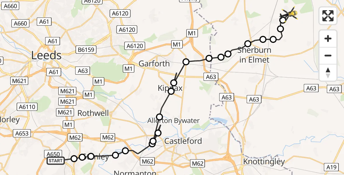
On Wednesday, 18 March 2026 at 14:23, a Police Helicopter departed from Wrenthorpe to Leeds East Airport. It was the Police Helicopter with registration number G-POLC. The flight lasted 12 minutes. During that period, the aircraft travelled 22 miles at an average speed of 109 miles per hour at a maximum altitude of 800 feet.
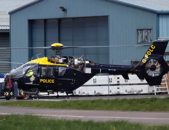
Helicopter: G-POLC
The helicopter G-POLC is used by the British police. The helicopter is deployed in pursuits, missing persons cases and other incidents where a helicopter provides added value.
Photo: James
22 miles
800 feet
109 mph
12 minutes
14:23
14:35

Route
Leeds East Airport, Tadcaster, North Yorkshire14:35
Tadcaster, York and North Yorkshire14:34
Church Fenton, York and North Yorkshire14:34
Little Fenton, York and North Yorkshire14:33
Sherburn in Elmet, York and North Yorkshire14:33
Barkston Ash, York and North Yorkshire14:32
Sherburn in Elmet, York and North Yorkshire14:31
Huddleston with Newthorpe, York and North Yorkshire14:31
Micklefield, Leeds14:30
Micklefield, Leeds14:29
Kippax, Leeds14:28
Great Preston, Kippax14:28
Allerton Bywater, Leeds14:27
Methley Junction, Leeds14:27
Lower Mickletown, Leeds14:27
Methley Junction, Leeds14:26
Altofts, Normanton and Altofts14:25
Altofts, Wakefield14:25
Stanley, Wakefield14:24
Lofthouse Gate, Wakefield14:24
Newton Hill, Wakefield14:24
A650, Wakefield14:23
Live flights
Today
Flights Wrenthorpe
Police Helicopter to East Ardsley, Stoney Lane13 Jul 16:37
Police Helicopter to East Ardsley, Stoney Lane11 Jul 20:42
Police Helicopter to East Ardsley, Stoney Lane11 Jul 10:06
Police Helicopter to East Ardsley, M110 Jul 23:38
Police Helicopter to East Ardsley, M19 Jul 21:52
Police Helicopter to Brandy Carr, M13 Jul 07:27
Helicopter flights on your website?
You can easily display helicopter flights on your own website. Use the embed code.
