Air Ambulance Helicopter to Thornton, Rippingale Way
Wednesday, 18 March 2026 | 13:14 | From Lancaster

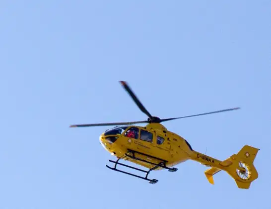
On Wednesday, 18 March 2026 at 13:14, a Air Ambulance Helicopter departed from Lancaster to Thornton. It was the Air Ambulance Helicopter with registration number G-NWAA. The flight lasted 10 minutes. During that period, the aircraft travelled 16 miles at an average speed of 101 miles per hour at a maximum altitude of 625 feet.
Helicopter: G-NWAA
The helicopter G-NWAA is used as a air ambulance helicopter. The main purpose of this aircraft is to transport a Mobile Medical Team to an incident as quickly as possible, enabling the trauma doctor to provide immediate first aid on site. The aircraft is flying this flight as Air Ambulance Helicopter.
Photo: David P Howard
17 miles
625 feet
101 mph
10 minutes
13:14
13:23

Route
Rippingale Way, Wyre13:23
Thornton, Wyre13:20
Fleetwood, Wyre13:20
Preesall, Wyre13:19
Pilling, Wyre13:18
Wyre, Wyre13:17
Lancaster, Lancaster13:17
Overton, Lancaster13:15
Middleton, Lancaster13:15
Clay Lane, Lancaster13:14
Live flights
Today
Flights Thornton
Air Ambulance Helicopter to Blackpool Airport27 Apr 13:17
Police Helicopter to Glencarse18 Apr 20:38
Air Ambulance Helicopter to Thornton10 Apr 22:17
Flights Lancaster
Air Ambulance Helicopter to Blackpool Airport11 Jul 11:17
Air Ambulance Helicopter to Blackpool Airport30 Jun 15:32
Air Ambulance Helicopter to Lancaster24 Jun 15:16
Air Ambulance Helicopter to Lancaster6 Jun 13:42
Coastguard Helicopter to Lancaster, The Prom27 May 20:43
Helicopter flights on your website?
You can easily display helicopter flights on your own website. Use the embed code.
