Air Ambulance Helicopter to South Crosland, Healey Houses
Wednesday, 18 March 2026 | 9:32 | From YAA Nostell Helicopter Port
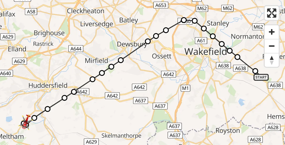
On Wednesday, 18 March 2026 at 9:32, a Air Ambulance Helicopter departed from YAA Nostell Helicopter Port to South Crosland. It was the Air Ambulance Helicopter with registration number G-YORX. The flight lasted 11 minutes. During that period, the aircraft travelled 22 miles at an average speed of 120 miles per hour at a maximum altitude of 1425 feet.
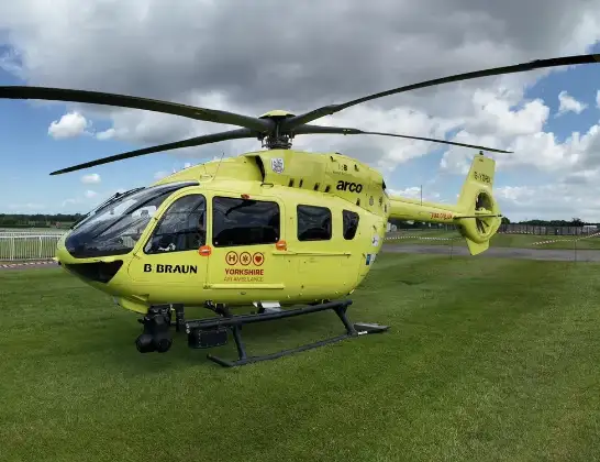
Helicopter: G-YORX
The helicopter G-YORX is used as a air ambulance helicopter. The main purpose of this aircraft is to transport a Mobile Medical Team to an incident as quickly as possible, enabling the trauma doctor to provide immediate first aid on site. The aircraft is flying this flight as Air Ambulance Helicopter.
Photo: Arollin96227
22 miles
1425 feet
120 mph
11 minutes
09:32
09:43

Route
Healey Houses, Meltham09:43
South Crosland, Meltham09:43
South Crosland, Kirklees09:42
Netherton, Kirklees09:42
Armitage Bridge, Kirklees09:41
Almondbury, Kirklees09:40
Lascelles Hall, Kirklees09:40
Kirkburton, Kirklees09:39
Lower Hopton, Mirfield09:39
Mirfield, Kirklees09:39
Overthorpe, Kirklees09:38
Dewsbury, Kirklees09:37
Gawthorpe, Wakefield09:37
Woodkirk, Leeds09:37
East Ardsley, Leeds09:36
Lofthouse Gate, Wakefield09:36
Newton Hill, Wakefield09:36
Stanley, Wakefield09:35
Heath, Wakefield09:35
Kirkthorpe, Wakefield09:35
Warmfield, Wakefield09:34
Sharlston, Wakefield09:33
YAA Nostell Helicopter Port, Foulby, Nostell, Yorkshire09:33
YAA Nostell Helicopter Port, Foulby, Nostell, Yorkshire09:32
Today
Helicopter flights on your website?
You can easily display helicopter flights on your own website. Use the embed code.
