Police Helicopter to Metropolitan Police Air Support Unit Lippitts Hill
Tuesday, 17 March 2026 | 14:07 | From London Borough of Waltham Forest
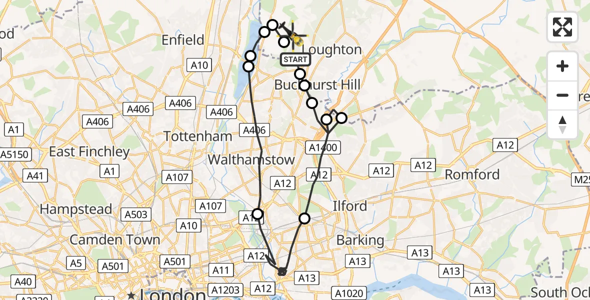
On Tuesday, 17 March 2026 at 14:07, a Police Helicopter departed from London Borough of Waltham Forest to Metropolitan Police Air Support Unit Lippitts Hill. It was the Police Helicopter with registration number G-MPSA. The flight lasted 17 minutes. During that period, the aircraft travelled 27 miles at an average speed of 98 miles per hour at a maximum altitude of 1000 feet.
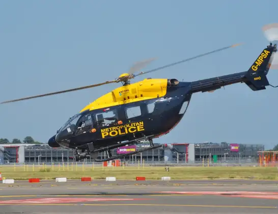
Helicopter: G-MPSA
The helicopter G-MPSA is used by the British police. The helicopter is deployed in pursuits, missing persons cases and other incidents where a helicopter provides added value.
Photo: Simon Boddy
28 miles
1000 feet
98 mph
17 minutes
14:07
14:24

Route
Metropolitan Police Air Support Unit Lippitts Hill, Loughton, Essex14:24
Sewardstonebury, Greater London14:23
Epping Forest, Epping Forest14:23
Sewardstonebury, Greater London14:23
King George V Reservoir14:22
William Girling Reservoir14:22
London Borough of Waltham Forest, Greater London14:19
London Borough of Newham, Greater London14:12
London Borough of Redbridge, Greater London14:09
Chigwell, Epping Forest14:09
London Borough of Redbridge, Greater London14:08
Buckhurst Hill, Epping Forest14:07
London Borough of Waltham Forest, Greater London14:07
Main path, Greater London14:07
Today
Helicopter flights on your website?
You can easily display helicopter flights on your own website. Use the embed code.
