Police Helicopter to London Borough of Enfield, Raynton Road
Tuesday, 17 March 2026 | 2:24 | From Metropolitan Police Air Support Unit Lippitts Hill
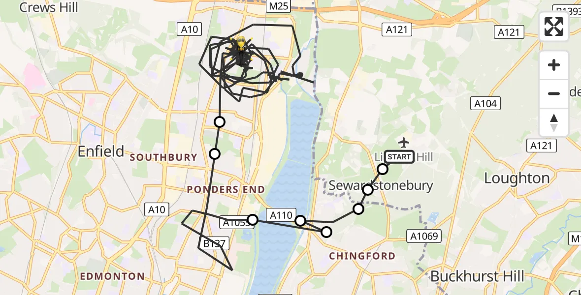
On Tuesday, 17 March 2026 at 2:24, a Police Helicopter departed from Metropolitan Police Air Support Unit Lippitts Hill to London Borough of Enfield. It was the Police Helicopter with registration number G-MPSA. The flight lasted 62 minutes. During that period, the aircraft travelled 34 miles at an average speed of 34 miles per hour at a maximum altitude of 1300 feet.
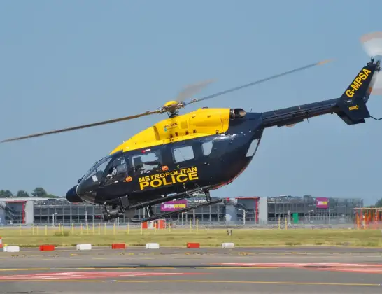
Helicopter: G-MPSA
The helicopter G-MPSA is used by the British police. The helicopter is deployed in pursuits, missing persons cases and other incidents where a helicopter provides added value.
Photo: Simon Boddy
35 miles
1300 feet
34 mph
62 minutes
02:24
03:26

Route
Raynton Road, Greater London03:26
London Borough of Enfield, Greater London02:29
Enfield, Greater London02:29
London Borough of Enfield, Greater London02:26
London Borough of Waltham Forest, Greater London02:26
London Borough of Enfield, Greater London02:26
London Borough of Waltham Forest, Greater London02:25
Sewardstonebury, Epping Forest02:25
Sewardstonebury, Greater London02:24
Bury Road, Greater London02:24
Live flights
Today
Helicopter flights on your website?
You can easily display helicopter flights on your own website. Use the embed code.
