Air Ambulance Helicopter to Belfast, Indiana Avenue
Monday, 16 March 2026 | 13:02 | From Mid and East Antrim District
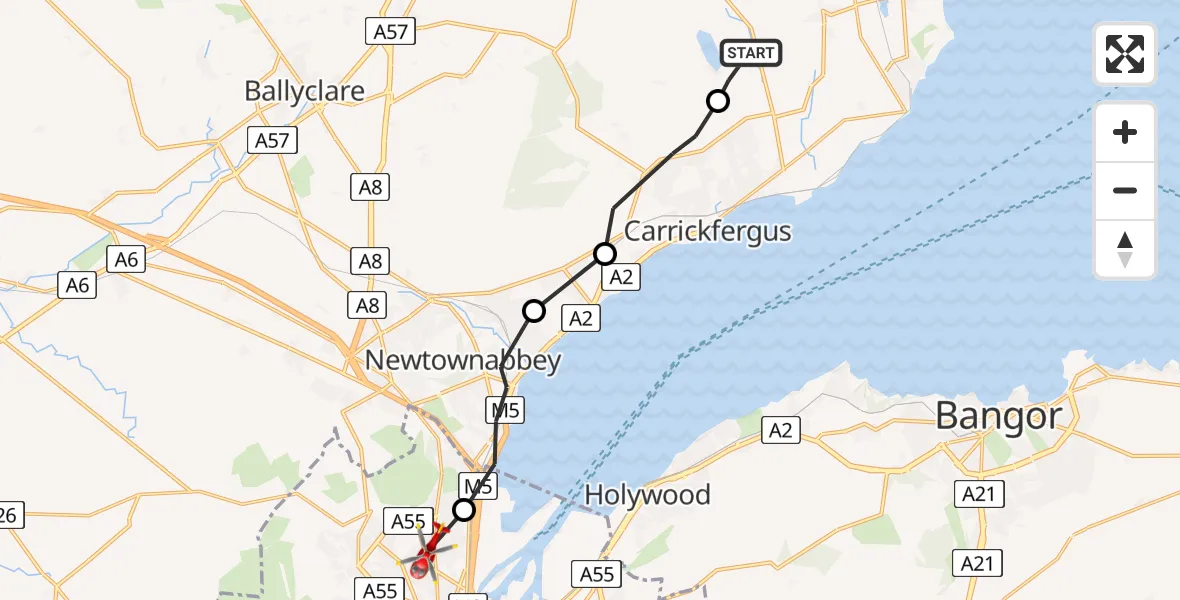
On Monday, 16 March 2026 at 13:02, a Air Ambulance Helicopter departed from Mid and East Antrim District to Belfast. It was the Air Ambulance Helicopter with registration number G-HEMZ. The flight lasted 5 minutes. During that period, the aircraft travelled 12 miles at an average speed of 138 miles per hour at a maximum altitude of 1700 feet.
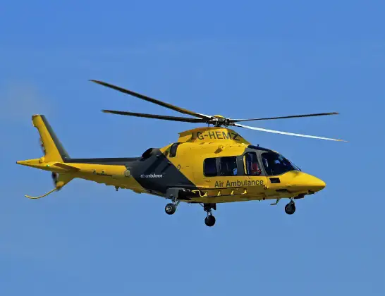
Helicopter: G-HEMZ
The helicopter G-HEMZ is used as a air ambulance helicopter. The main purpose of this aircraft is to transport a Mobile Medical Team to an incident as quickly as possible, enabling the trauma doctor to provide immediate first aid on site. The aircraft is flying this flight as Air Ambulance Helicopter.
Photo: Rob Hodgkins
12 miles
1700 feet
138 mph
6 minutes
13:02
13:07

Route
Indiana Avenue, Belfast City District13:07
Belfast, Belfast City District13:07
Newtownabbey, Antrim and Newtownabbey District13:05
Greenisland, Mid and East Antrim District13:04
Carrickfergus, Mid and East Antrim District13:03
Beltoy Road, Mid and East Antrim District13:02
Live flights
Police Helicopter on its way from Elsrickle6 Jul 23:09
Police Helicopter on its way from Coopersale6 Jul 22:57
Today
Police Helicopter to Lochhead, A726 Jul 22:39
Air Ambulance Aircraft to Greenigoe6 Jul 21:45
Coastguard Helicopter to Humberside Airport6 Jul 21:43
Air Ambulance Helicopter to RAF Northolt6 Jul 21:24
Police Helicopter to Birmingham Airport6 Jul 21:17
Flights Belfast
Police Helicopter to Belfast, Whiterock Crescent30 Mar 15:23
Police Helicopter to Belfast, Shankill Road30 Mar 15:19
Police Helicopter to Belfast, Springfield Road30 Mar 15:11
Police Helicopter to Belfast, Willowvale Gardens30 Mar 15:08
Police Helicopter to Belfast, M130 Mar 14:47
Police Helicopter to Belfast, Brooke Drive29 Mar 14:55
Police Helicopter to Belfast, Springhill Rise29 Mar 14:46
Police Helicopter to Belfast, Oranmore Drive29 Mar 14:41
Helicopter flights on your website?
You can easily display helicopter flights on your own website. Use the embed code.
