Air Ambulance Helicopter to Rockbeare, Westcott Road
Monday, 16 March 2026 | 1:32 | From North Devon
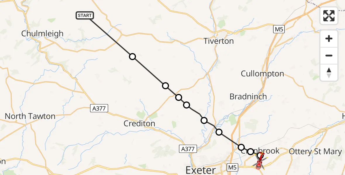
On Monday, 16 March 2026 at 1:32, a Air Ambulance Helicopter departed from North Devon to Rockbeare. It was the Air Ambulance Helicopter with registration number G-DAAN. The flight lasted 7 minutes. During that period, the aircraft travelled 22 miles at an average speed of 182 miles per hour at a maximum altitude of 2000 feet.

Helicopter: G-DAAN
The helicopter G-DAAN is used as a air ambulance helicopter. The main purpose of this aircraft is to transport a Mobile Medical Team to an incident as quickly as possible, enabling the trauma doctor to provide immediate first aid on site. The aircraft is flying this flight as Air Ambulance Helicopter.
Photo: Tim Felce (Airwolfhound)
22 miles
2000 feet
182 mph
8 minutes
01:32
01:39

Route
Westcott Road, East Devon01:39
Rockbeare, East Devon01:39
Cranbrook, East Devon01:38
Broadclyst, Exeter01:38
Huxham, East Devon01:37
Rewe, East Devon01:37
Thorverton, Mid Devon01:36
Stockleigh Pomeroy, Mid Devon01:36
Cheriton Fitzpaine, Mid Devon01:35
Puddington, Mid Devon01:34
North Devon, Devon and Torbay01:32
Live flights
Today
Police Helicopter to RAF Benson13:27:37
Flights Rockbeare
Police Helicopter to Southgate, Eastcliff11 Jul 18:41
Police Helicopter to Rockbeare, Silver Lane5 Jul 20:57
Police Helicopter to Rockbeare, Gribble Lane5 Jul 16:32
Police Helicopter to Rockbeare, Silver Lane4 Jul 18:20
Police Helicopter to Rockbeare, Westcott Road30 Jun 18:50
Police Helicopter to Rockbeare, Westcott Road29 Jun 16:58
Helicopter flights on your website?
You can easily display helicopter flights on your own website. Use the embed code.
