Air Ambulance Helicopter to Test Valley, Knightwood Road
Sunday, 15 March 2026 | 13:37 | From Test Valley
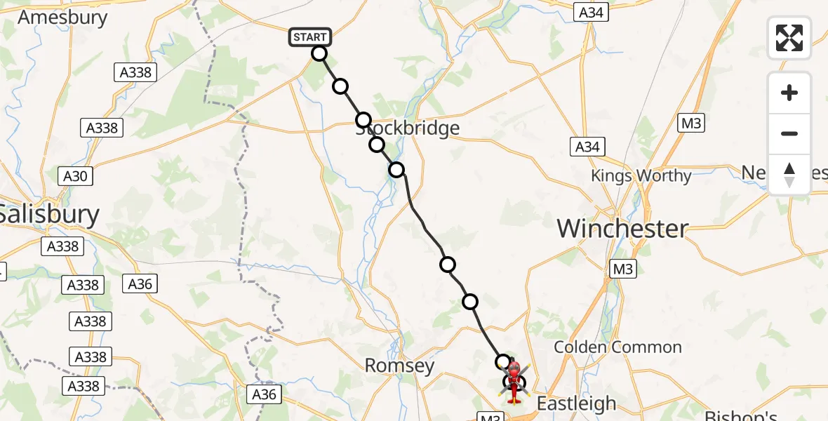
On Sunday, 15 March 2026 at 13:37, a Air Ambulance Helicopter departed from Test Valley to Test Valley. It was the Air Ambulance Helicopter with registration number G-HIOW. The flight lasted 19 minutes. During that period, the aircraft travelled 16 miles at an average speed of 53 miles per hour at a maximum altitude of 1425 feet.
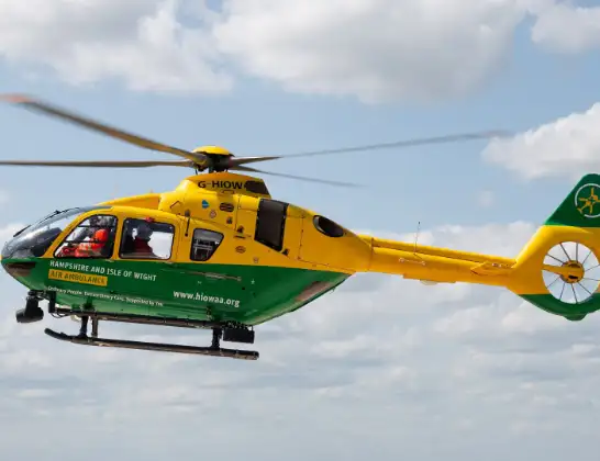
Helicopter: G-HIOW
The helicopter G-HIOW is used as a air ambulance helicopter. The main purpose of this aircraft is to transport a Mobile Medical Team to an incident as quickly as possible, enabling the trauma doctor to provide immediate first aid on site. The aircraft is flying this flight as Air Ambulance Helicopter.
Photo: JF2608
17 miles
1425 feet
53 mph
19 minutes
13:37
13:55

Route
Test Valley, Test Valley13:55
Knightwood Road, Test Valley13:46
Skys Wood Road, Test Valley13:46
Test Valley, Test Valley13:45
Chandler's Ford, Chandler's Ford13:45
Pilgrims Close, Test Valley13:44
Test Valley, Test Valley13:44
Ampfield, Test Valley13:43
Braishfield, Test Valley13:42
King's Somborne, Test Valley13:40
Houghton, Test Valley13:39
Nether Wallop, Test Valley13:39
Test Valley, Test Valley13:38
Middle Wallop Airfield, Middle Wallop13:37
Old Stockbridge Road, Test Valley13:37
Live flights
Today
Coastguard Helicopter to Corrie15:48:56
Helicopter flights on your website?
You can easily display helicopter flights on your own website. Use the embed code.
