Air Ambulance Helicopter to Burton upon Trent, Meadowside Drive
Sunday, 15 March 2026 | 10:23 | From Willoughby on the Wolds
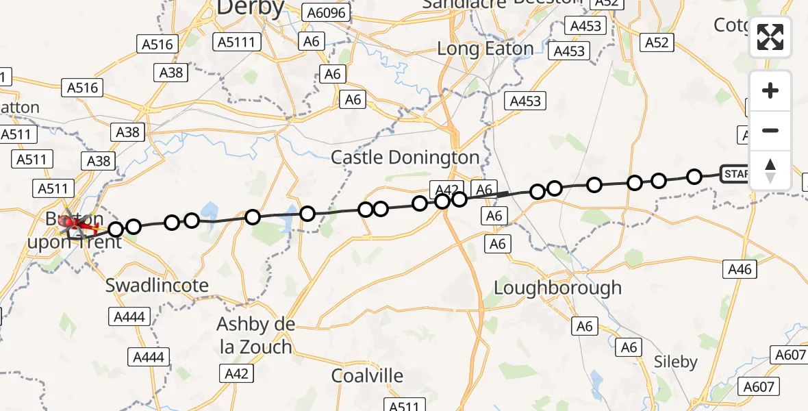
On Sunday, 15 March 2026 at 10:23, a Air Ambulance Helicopter departed from Willoughby on the Wolds to Burton upon Trent. It was the Air Ambulance Helicopter with registration number G-DRLA. The flight lasted 13 minutes. During that period, the aircraft travelled 28 miles at an average speed of 131 miles per hour at a maximum altitude of 1350 feet.
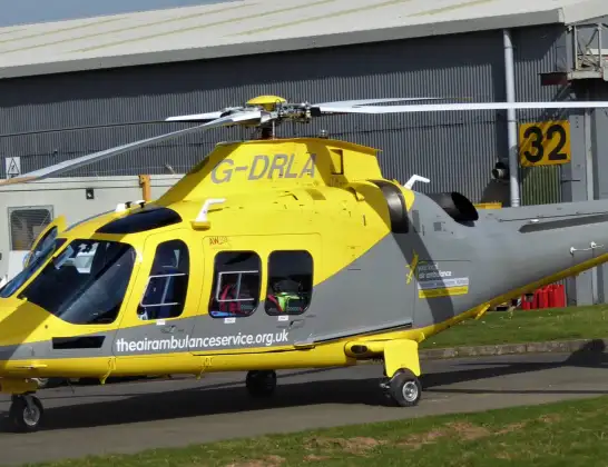
Helicopter: G-DRLA
The helicopter G-DRLA is used as an ambulance helicopter. The helicopter is equipped with a stretcher for transporting patients. The helicopter is often used to transport to hospitals.
Photo: Alec Wilson
29 miles
1350 feet
131 mph
14 minutes
10:23
10:36

Route
Meadowside Drive, East Staffordshire10:36
Burton upon Trent, East Staffordshire10:33
Newhall, South Derbyshire10:33
Bretby, South Derbyshire10:32
Repton CP, South Derbyshire10:32
Ticknall CP, South Derbyshire10:31
Melbourne CP, South Derbyshire10:30
Breedon on the Hill, North West Leicestershire10:29
Isley Walton, Derby10:29
Diseworth, Derby10:28
Lockington, Derby10:28
Long Whatton, North West Leicestershire10:28
Sutton Bonington, Rushcliffe10:27
Normanton on Soar, Rushcliffe10:26
East Leake, Rushcliffe10:26
Costock, Rushcliffe10:25
Rempstone, Rushcliffe10:25
Wysall, Rushcliffe10:24
Mill Lane, Rushcliffe10:23
Live flights
Police Helicopter on its way from Dundrod12 Jul 22:50
Today
Police Helicopter to East Ardsley, Stoney Lane12 Jul 23:51
Police Helicopter to Birmingham Airport12 Jul 23:46
Police Helicopter to Parkham Ash12 Jul 23:41
Air Ambulance Helicopter to Newlands of Culloden12 Jul 23:24
Helicopter flights on your website?
You can easily display helicopter flights on your own website. Use the embed code.
