Coastguard Helicopter to Aviemore, Inverness Airport
Saturday, 14 March 2026 | 14:50 | From Inverness Airport
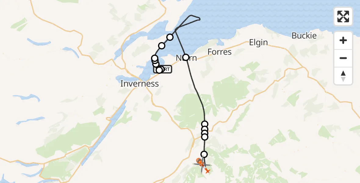
On Saturday, 14 March 2026 at 14:50, a Coastguard Helicopter departed from Inverness Airport to Aviemore. It was the Coastguard Helicopter with registration number G-MCGX. The flight lasted 43 minutes. During that period, the aircraft travelled 74 miles at an average speed of 104 miles per hour at a maximum altitude of 3175 feet.
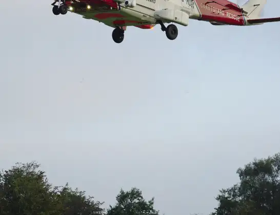
Helicopter: G-MCGX
The helicopter G-MCGX is used by the British Coastguard. The helicopter is deployed in search and rescue operations at sea, rescue operations involving ships or drilling platforms, patrols to prevent smuggling or piracy, environmental monitoring and disaster relief support.
Photo: Nick (UK)
74 miles
3175 feet
104 mph
43 minutes
14:50
15:33

Route
15:33
Aviemore, Aviemore15:30
Boat of Garten, Boat of Garten15:27
Dulnain Bridge, Dulnain Bridge15:27
Carrbridge, Carrbridge15:26
Dulnain Bridge, Dulnain Bridge15:25
Nairn, Nairn15:16
North Sea14:58
Cromarty, Cromarty14:56
Rosemarkie, Rosemarkie14:54
Fortrose, Fortrose14:53
Rosemarkie, Rosemarkie14:53
Inverness, Inverness14:51
Tornagrain, Tornagrain14:51
Inverness Airport, Inverness14:50
Live flights
Today
Flights Aviemore
Coastguard Helicopter to Càrn Dubh5 Jul 13:52
Coastguard Helicopter to Inverness Airport30 Jun 16:15
Coastguard Helicopter to Aviemore, B915212 Jun 14:41
Coastguard Helicopter to Ciste Mhearad26 May 10:18
Coastguard Helicopter to Aviemore24 May 15:54
Coastguard Helicopter to Inverness Airport24 May 00:39
Coastguard Helicopter to Aviemore7 May 16:35
Air Ambulance Helicopter to Aviemore23 Apr 18:42
Coastguard Helicopter to Aviemore, The Glen22 Apr 12:06
Helicopter flights on your website?
You can easily display helicopter flights on your own website. Use the embed code.
