Air Ambulance Helicopter to Rushcliffe, Folly Hall Lane
Saturday, 14 March 2026 | 11:42 | From Newark and Sherwood
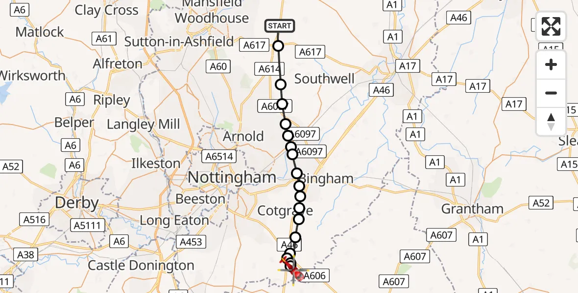
On Saturday, 14 March 2026 at 11:42, a Air Ambulance Helicopter departed from Newark and Sherwood to Rushcliffe. It was the Air Ambulance Helicopter with registration number G-DRLA. The flight lasted 8 minutes. During that period, the aircraft travelled 22 miles at an average speed of 162 miles per hour at a maximum altitude of 1350 feet.
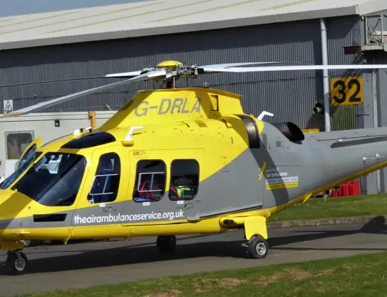
Helicopter: G-DRLA
The helicopter G-DRLA is used as an ambulance helicopter. The helicopter is equipped with a stretcher for transporting patients. The helicopter is often used to transport to hospitals.
Photo: Alec Wilson
22 miles
1350 feet
162 mph
9 minutes
11:42
11:51

Route
Folly Hall Lane, East Midlands11:51
Nottingham Heliport11:50
Hickling, Rushcliffe11:50
Widmerpool, Rushcliffe11:50
Hickling, Rushcliffe11:49
Kinoulton, Rushcliffe11:49
Owthorpe, Rushcliffe11:48
Cropwell Bishop, Rushcliffe11:48
Cropwell Bishop, Cotgrave11:48
Upper Saxondale, Rushcliffe11:47
Radcliffe on Trent, Rushcliffe11:47
Shelford, Rushcliffe11:46
Burton Joyce, Gedling11:46
Lowdham CP, Newark and Sherwood11:46
Woodborough, Gedling11:45
Epperstone CP, Newark and Sherwood11:45
Oxton CP, Newark and Sherwood11:44
Farnsfield, Newark and Sherwood11:43
Old Rufford Road, East Midlands11:42
Live flights
Flights Rushcliffe
Air Ambulance Helicopter to Rushcliffe, A461 Jul 18:42
Air Ambulance Helicopter to Ashwell, Oakham30 Jun 12:44
Air Ambulance Helicopter to Rushcliffe, A4629 Jun 11:54
Air Ambulance Helicopter to East Carlton, A42727 Jun 11:00
Air Ambulance Helicopter to Ab Kettleby26 Jun 11:47
Helicopter flights on your website?
You can easily display helicopter flights on your own website. Use the embed code.
