Police Helicopter to Epping Forest, Avey Lane
Saturday, 14 March 2026 | 8:49 | From Sewardstonebury
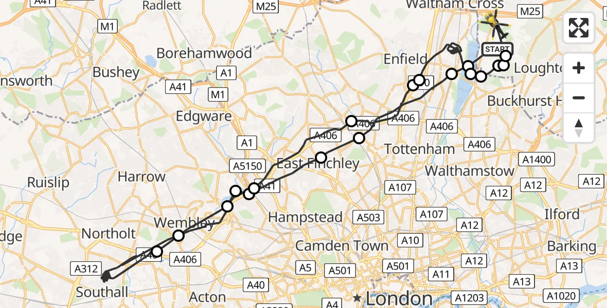
On Saturday, 14 March 2026 at 8:49, a Police Helicopter departed from Sewardstonebury to Epping Forest. It was the Police Helicopter with registration number G-MPSA. The flight lasted 39 minutes. During that period, the aircraft travelled 58 miles at an average speed of 89 miles per hour at a maximum altitude of 1700 feet.
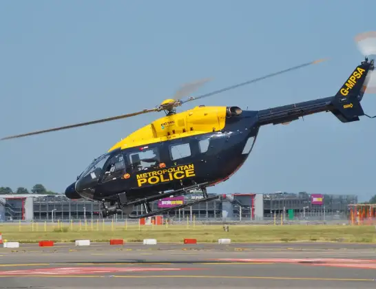
Helicopter: G-MPSA
The helicopter G-MPSA is used by the British police. The helicopter is deployed in pursuits, missing persons cases and other incidents where a helicopter provides added value.
Photo: Simon Boddy
58 miles
1700 feet
89 mph
40 minutes
08:49
09:28

Route
Avey Lane, Epping Forest09:28
Metropolitan Police Air Support Unit Lippitts Hill, Loughton, Essex09:28
Sewardstonebury, Greater London09:28
Sewardstonebury, Epping Forest09:27
London Borough of Waltham Forest, Greater London09:27
King George V Reservoir09:27
London Borough of Enfield, Greater London09:21
Enfield, Greater London09:21
London Borough of Enfield, Greater London09:18
London Borough of Barnet, Greater London09:15
London Borough of Brent, Greater London09:13
London Borough of Ealing, Greater London08:56
London Borough of Brent, Greater London08:55
London Borough of Barnet, Greater London08:55
London Borough of Brent, Greater London08:54
London Borough of Barnet, Greater London08:53
London Borough of Haringey, Greater London08:52
London Borough of Enfield, Greater London08:50
King George V Reservoir08:50
Green Lane, Epping Forest08:49
Live flights
Today
Flights Sewardstonebury
Police Helicopter to Sewardstonebury, Bury Road10 Jun 21:58
Police Helicopter to Sewardstonebury, Blind Lane10 Jun 18:19
Police Helicopter to Sewardstonebury, Green Ride10 Jun 16:35
Police Helicopter to Kingsbury, Cool Oak Lane10 Jun 15:59
Helicopter flights on your website?
You can easily display helicopter flights on your own website. Use the embed code.
