Air Ambulance Helicopter to Calne, The Glebe
Saturday, 14 March 2026 | 0:03 | From Wiltshire Air Ambulance
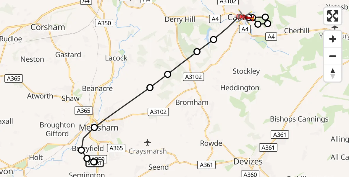
On Saturday, 14 March 2026 at 0:03, a Air Ambulance Helicopter departed from Wiltshire Air Ambulance to Calne. It was the Air Ambulance Helicopter with registration number G-WLTS. The flight lasted 10 minutes. During that period, the aircraft travelled 12 miles at an average speed of 72 miles per hour at a maximum altitude of 1825 feet.
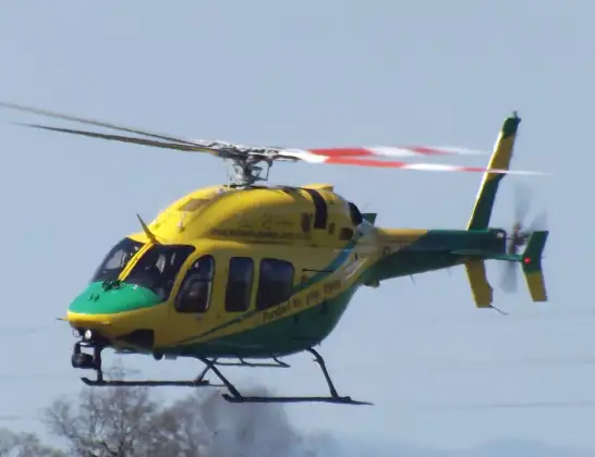
Helicopter: G-WLTS
The helicopter G-WLTS is used as a air ambulance helicopter. The main purpose of this aircraft is to transport a Mobile Medical Team to an incident as quickly as possible, enabling the trauma doctor to provide immediate first aid on site. The aircraft is flying this flight as Air Ambulance Helicopter.
Photo: James
12 miles
1825 feet
72 mph
10 minutes
00:03
00:13

Route
The Glebe, Calne00:13
Calne, Calne00:12
Lower Compton, Calne00:12
Compton Bassett, Compton Bassett00:11
Lower Compton, Lower Compton00:11
Compton Bassett, Compton Bassett00:11
Calne, Calne00:10
Derry Hill and Studley, Derry Hill and Studley00:10
Bromham, Bromham00:09
Bowden Hill, Bowden Hill00:09
Melksham, Melksham00:08
Berryfield, Berryfield00:07
Semington, Semington00:07
Trowbridge, Trowbridge00:07
Commerce Way, Melksham00:06
Melksham, Melksham00:06
Wiltshire Air Ambulance00:03
Live flights
Coastguard Helicopter on its way from North Sea14 Jul 23:44
Today
Air Ambulance Helicopter to Redhill Aerodrome14 Jul 23:46
Police Helicopter to Johnstone, Gordon Square14 Jul 23:38
Coastguard Helicopter to North Sea14 Jul 23:30
Police Helicopter to Inner Seas14 Jul 23:12
Air Ambulance Helicopter to Norwich Airport14 Jul 22:52
Police Helicopter to Manchester Barton Aerodrome14 Jul 22:50
Police Helicopter to Sewardstonebury, Bury Road14 Jul 22:44
Flights Calne
Air Ambulance Helicopter to Calne, Lower Compton21 May 18:26
Air Ambulance Helicopter to Calne, Zander Road15 May 09:50
Air Ambulance Helicopter to Calne, Eadred's Hyde13 May 07:32
Helicopter flights on your website?
You can easily display helicopter flights on your own website. Use the embed code.
