Air Ambulance Helicopter to Newcastle Royal Victoria Infirmary
Friday, 13 March 2026 | 17:31 | From West Boldon
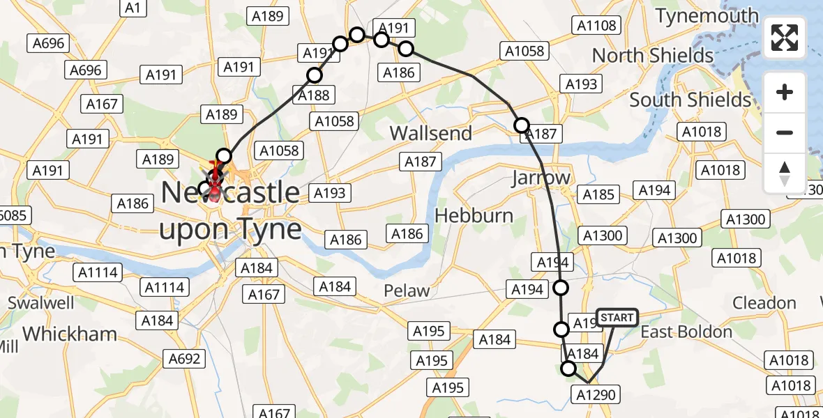
On Friday, 13 March 2026 at 17:31, a Air Ambulance Helicopter departed from West Boldon to Newcastle Royal Victoria Infirmary. It was the Air Ambulance Helicopter with registration number G-NHAE. The flight lasted 10 minutes. During that period, the aircraft travelled 13 miles at an average speed of 81 miles per hour at a maximum altitude of 1725 feet.
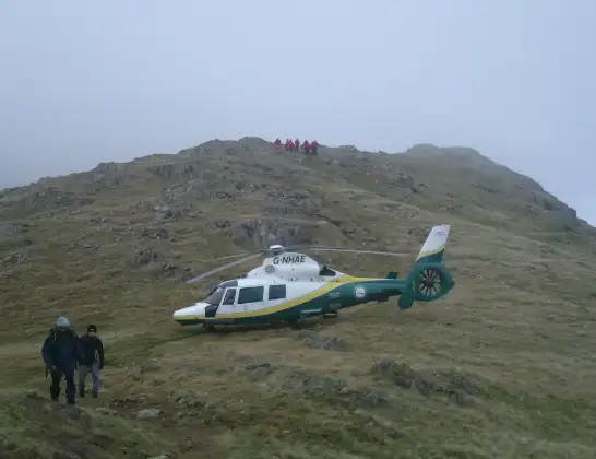
Helicopter: G-NHAE
The helicopter G-NHAE is used as a air ambulance helicopter. The main purpose of this aircraft is to transport a Mobile Medical Team to an incident as quickly as possible, enabling the trauma doctor to provide immediate first aid on site. The aircraft is flying this flight as Air Ambulance Helicopter.
Photo: Michael Earnshaw
14 miles
1725 feet
81 mph
10 minutes
17:31
17:41

Route
Newcastle Royal Victoria Infirmary, Newcastle upon Tyne17:41
Newcastle Royal Victoria Infirmary, Newcastle upon Tyne17:41
Newcastle upon Tyne, North East17:40
Newcastle Royal Victoria Infirmary, Newcastle upon Tyne17:40
Newcastle Royal Victoria Infirmary, Newcastle upon Tyne17:39
Newcastle upon Tyne, North East17:39
Newcastle Royal Victoria Infirmary, Newcastle upon Tyne17:39
Newcastle Royal Victoria Infirmary, Newcastle upon Tyne17:38
Newcastle upon Tyne, North East17:36
Forest Hall, North Tyneside17:36
Forest Hall, North Tyneside17:36
Forest Hall, North Tyneside17:35
Wallsend, North Tyneside17:35
Wallsend, North Tyneside17:34
Jarrow, South Tyneside17:33
Hebburn, South Tyneside17:33
South Tyneside, North East17:32
Cotswold Lane, South Tyneside17:31
Today
Helicopter flights on your website?
You can easily display helicopter flights on your own website. Use the embed code.
