Police Helicopter to Newcastle upon Tyne
Friday, 13 March 2026 | 5:27 | From Newcastle International Airport
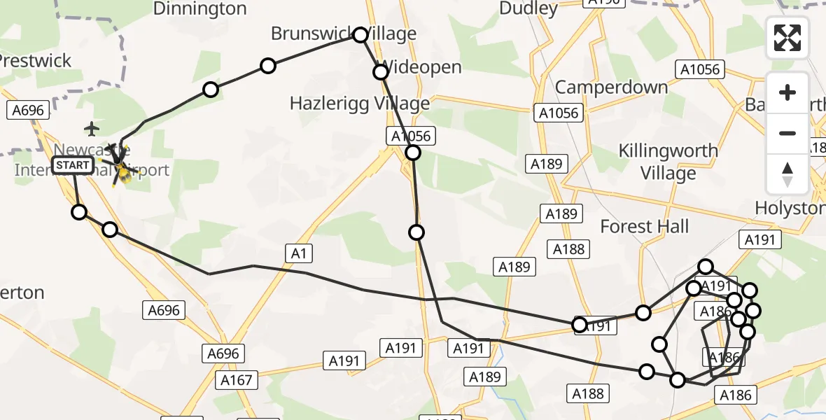
On Friday, 13 March 2026 at 5:27, a Police Helicopter departed from Newcastle International Airport to Newcastle upon Tyne. It was the Police Helicopter with registration number G-POLA. The flight lasted 13 minutes. During that period, the aircraft travelled 21 miles at an average speed of 95 miles per hour at a maximum altitude of 2600 feet.
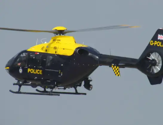
Helicopter: G-POLA
The helicopter G-POLA is used by the British police. The helicopter is deployed in pursuits, missing persons cases and other incidents where a helicopter provides added value.
Photo: ozz13x
22 miles
2600 feet
95 mph
14 minutes
05:27
05:40

Route
Newcastle upon Tyne, Newcastle upon Tyne05:40
Newcastle International Airport, Newcastle upon Tyne, Tyne and Wear05:38
Dinnington, Newcastle upon Tyne05:38
Brunswick Village, Newcastle upon Tyne05:37
Wideopen, North Tyneside05:37
Hazlerigg Village, Newcastle upon Tyne05:37
Newcastle upon Tyne, Newcastle upon Tyne05:36
Newcastle upon Tyne, North East05:35
Wallsend, North Tyneside05:32
Wallsend, North Tyneside05:32
Wallsend, North Tyneside05:32
Forest Hall, North Tyneside05:32
Wallsend, North Tyneside05:32
Newcastle upon Tyne, North East05:31
Wallsend, North Tyneside05:30
Holystone, North Tyneside05:30
Forest Hall, North Tyneside05:30
Forest Hall, North Tyneside05:29
Forest Hall, Newcastle upon Tyne05:29
Newcastle upon Tyne, Newcastle upon Tyne05:27
Callerton, Newcastle upon Tyne05:27
Ponteland Road, Newcastle upon Tyne05:27
Live flights
Today
Helicopter flights on your website?
You can easily display helicopter flights on your own website. Use the embed code.
