Police Helicopter to MOD St Athan
Wednesday, 11 March 2026 | 22:05 | From Almondsbury Helicopter Base
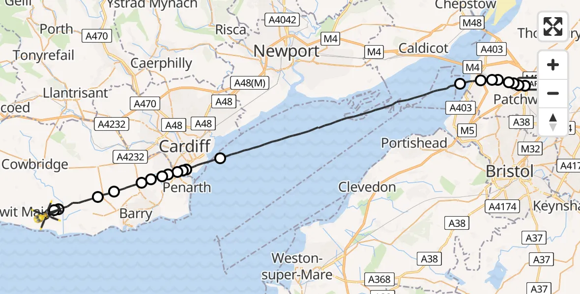
On Wednesday, 11 March 2026 at 22:05, a Police Helicopter departed from Almondsbury Helicopter Base to MOD St Athan. It was the Police Helicopter with registration number G-NWOI. The flight lasted 22 minutes. During that period, the aircraft travelled 39 miles at an average speed of 106 miles per hour at a maximum altitude of 1275 feet.

Helicopter: G-NWOI
The helicopter G-NWOI is used by the British police. The helicopter is deployed in pursuits, missing persons cases and other incidents where a helicopter provides added value.
Photo: Alec Wilson
40 miles
1275 feet
106 mph
23 minutes
22:05
22:27

Route
MOD St Athan, St Athan, Vale of Glamorgan22:27
Flemingston, Flemingston22:27
St Athan, St Athan22:27
Llancarfan, Llancarfan22:25
Dyffryn, Dyffryn22:24
Wenvoe, Wenvoe22:23
Dinas Powys, Dinas Powys22:23
Michaelston-le-Pit, Michaelston-le-Pit22:22
Dinas Powys, Dinas Powys22:22
Llandough, Llandough22:22
Cardiff, Cardiff22:21
Cardiff Bay22:21
Cardiff, Cardiff22:20
Bristol Channel22:09
Severn Beach, West of England22:08
Pilning, West of England22:08
Easter Compton, West of England22:07
Patchway, West of England22:07
Over, West of England22:07
Bristol, West of England22:06
Almondsbury, West of England22:06
Almondsbury Helicopter Base, Bristol, Somerset22:05
Live flights
Today
Helicopter flights on your website?
You can easily display helicopter flights on your own website. Use the embed code.
