Air Ambulance Helicopter to Llanberis, A2T Victoria Level
Wednesday, 11 March 2026 | 15:06 | From Caernarfon Airport
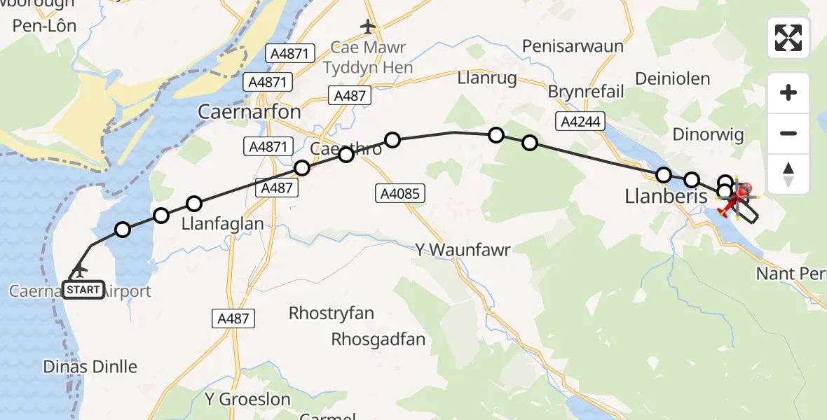
On Wednesday, 11 March 2026 at 15:06, a Air Ambulance Helicopter departed from Caernarfon Airport to Llanberis. It was the Air Ambulance Helicopter with registration number G-WOBR. The flight lasted 11 minutes. During that period, the aircraft travelled 13 miles at an average speed of 73 miles per hour at a maximum altitude of 1950 feet.
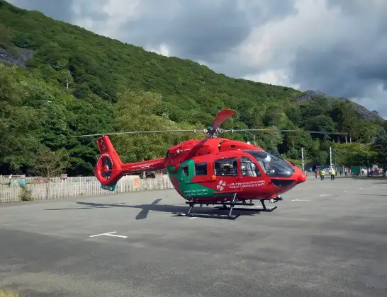
Helicopter: G-WOBR
The helicopter G-WOBR is used as a air ambulance helicopter. The main purpose of this aircraft is to transport a Mobile Medical Team to an incident as quickly as possible, enabling the trauma doctor to provide immediate first aid on site. The aircraft is flying this flight as Air Ambulance Helicopter.
Photo: Hefin Owen
14 miles
1950 feet
73 mph
12 minutes
15:06
15:17

Route
A2T Victoria Level, Llanberis15:17
Llanberis, Llanberis15:14
Dinorwig, Dinorwig15:14
Llanberis, Llanberis15:12
Llyn Padarn15:12
Llanberis, Llanberis15:11
Waunfawr, Waunfawr15:11
Llanrug, Llanrug15:10
Caeathro, Caeathro15:10
Bontnewydd, Bontnewydd15:10
Llanfaglan, Llanfaglan15:09
Bontnewydd, Bontnewydd15:09
Llandwrog, Llandwrog15:09
Caernarfon Airport, Caernarfon15:07
Caernarfon Airport, Caernarfon15:06
Today
Flights Llanberis
Air Ambulance Helicopter to Llanberis, A40865 Jul 14:22
Coastguard Helicopter to Caernarfon Airport26 Jun 11:54
Coastguard Helicopter to Llanberis, Dinorwig26 Jun 09:13
Coastguard Helicopter to Llanberis, A408626 May 19:16
Helicopter flights on your website?
You can easily display helicopter flights on your own website. Use the embed code.
