Air Ambulance Helicopter to Stafford, Two Waters Way
Wednesday, 11 March 2026 | 12:58 | From RAF Cosford
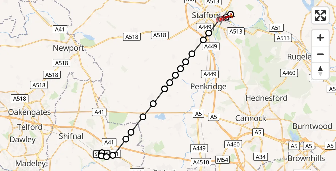
On Wednesday, 11 March 2026 at 12:58, a Air Ambulance Helicopter departed from RAF Cosford to Stafford. It was the Air Ambulance Helicopter with registration number G-RMAA. The flight lasted 9 minutes. During that period, the aircraft travelled 17 miles at an average speed of 112 miles per hour at a maximum altitude of 1300 feet.
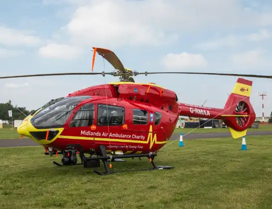
Helicopter: G-RMAA
The helicopter G-RMAA is used as a air ambulance helicopter. The main purpose of this aircraft is to transport a Mobile Medical Team to an incident as quickly as possible, enabling the trauma doctor to provide immediate first aid on site. The aircraft is flying this flight as Air Ambulance Helicopter.
Photo: Steve Lynes
18 miles
1300 feet
112 mph
10 minutes
12:58
13:08

Route
Two Waters Way, Stafford13:08
Stafford, Stafford13:07
Tixall, Stafford13:06
Stafford, Stafford13:05
Hyde Lea, Stafford13:05
Coppenhall, South Staffordshire13:04
Coppenhall, Penkridge13:04
Bradley, Stafford13:04
Bradley, Penkridge13:03
Mitton Airstrip13:03
Lapley, South Staffordshire13:03
Wheaton Aston, South Staffordshire13:02
Bishops Wood, South Staffordshire13:02
Tong, Tong13:01
Albrighton and Donington, Albrighton and Donington13:01
Cosford, Cosford13:00
RAF Cosford, Cosford13:00
Tong, Tong13:00
Shifnal, Shifnal12:59
Cosford, Cosford12:59
Airbase Avenue, Cosford12:58
Live flights
Flights Stafford
Air Ambulance Helicopter to West Lancashire22 Jun 09:15
Air Ambulance Helicopter to Stafford, A51825 May 17:40
Helicopter flights on your website?
You can easily display helicopter flights on your own website. Use the embed code.
