Air Ambulance Helicopter to Hull Royal Infirmary
Tuesday, 10 March 2026 | 19:56 | From Church Town
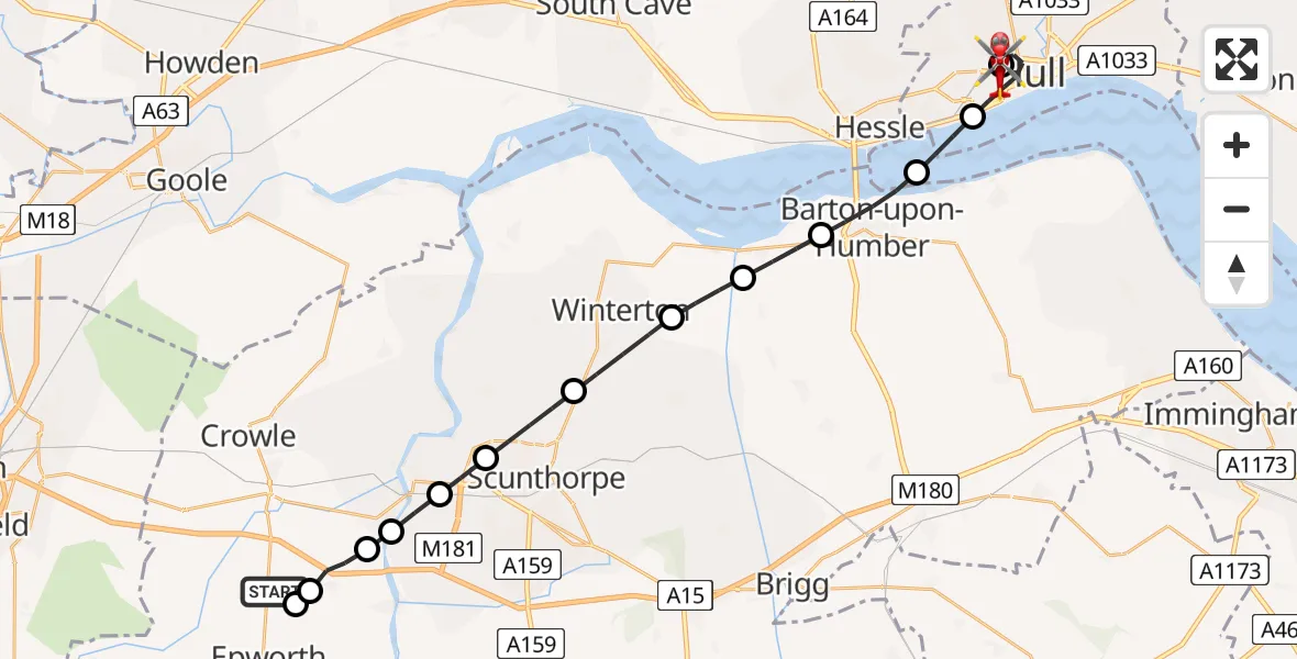
On Tuesday, 10 March 2026 at 19:56, a Air Ambulance Helicopter departed from Church Town to Hull Royal Infirmary. It was the Air Ambulance Helicopter with registration number G-LNCC. The flight lasted 13 minutes. During that period, the aircraft travelled 25 miles at an average speed of 121 miles per hour at a maximum altitude of 1675 feet.
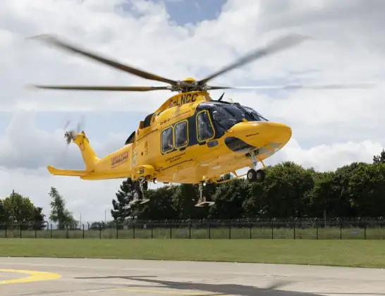
Helicopter: G-LNCC
The helicopter G-LNCC is used as a air ambulance helicopter. The main purpose of this aircraft is to transport a Mobile Medical Team to an incident as quickly as possible, enabling the trauma doctor to provide immediate first aid on site. The aircraft is flying this flight as Air Ambulance Helicopter.
Photo: Lincs & Notts
26 miles
1675 feet
121 mph
13 minutes
19:56
20:09

Route
Hull Royal Infirmary, Hull20:09
Hull Royal Infirmary, Hull20:08
Hull Royal Infirmary, Hull20:07
Hull, Hull and East Yorkshire20:05
North Sea20:04
Barton-upon-Humber, Greater Lincolnshire20:03
South Ferriby, Greater Lincolnshire20:02
Winterton, Greater Lincolnshire20:01
Roxby, Greater Lincolnshire20:00
Scunthorpe, Greater Lincolnshire19:59
Gunness, Greater Lincolnshire19:59
Burringham, Greater Lincolnshire19:58
West Butterwick, Greater Lincolnshire19:58
Beltoft, Greater Lincolnshire19:57
Bracon, Greater Lincolnshire19:57
Pashley Walk, Greater Lincolnshire19:56
Live flights
Police Helicopter on its way from Ewelme13 Jul 22:24
Today
Police Helicopter to Bournemouth Airport13 Jul 23:55
Air Ambulance Helicopter to Cardiff Heliport13 Jul 23:38
Police Helicopter to Birmingham Airport13 Jul 23:21
Police Helicopter to Irlam, Twelve Yards Road13 Jul 23:00
Helicopter flights on your website?
You can easily display helicopter flights on your own website. Use the embed code.
