Coastguard Helicopter to Llanfaethlu, Borthwen Barns
Tuesday, 10 March 2026 | 14:51 | From Caernarfon Airport
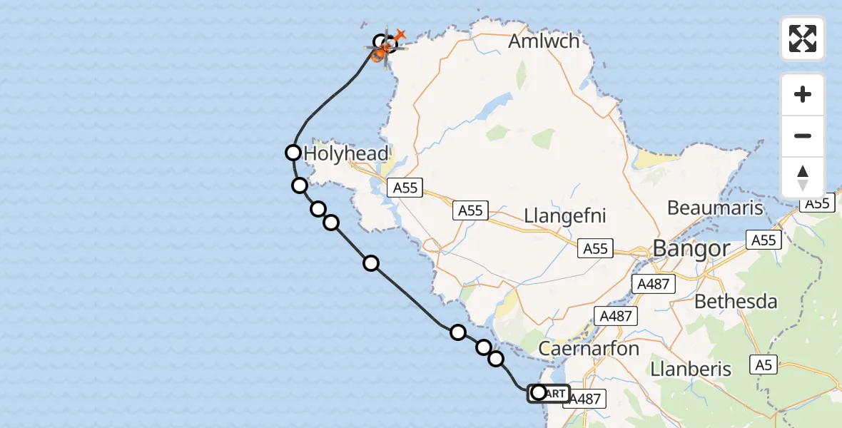
On Tuesday, 10 March 2026 at 14:51, a Coastguard Helicopter departed from Caernarfon Airport to Llanfaethlu. It was the Coastguard Helicopter with registration number G-RESI. The flight lasted 21 minutes. During that period, the aircraft travelled 32 miles at an average speed of 92 miles per hour at a maximum altitude of 550 feet.

Helicopter: G-RESI
The helicopter G-RESI is used by the British Coastguard. The helicopter is deployed in search and rescue operations at sea, rescue operations involving ships or drilling platforms, patrols to prevent smuggling or piracy, environmental monitoring and disaster relief support.
Photo: Tony Melony
33 miles
550 feet
92 mph
22 minutes
14:51
15:12

Route
Borthwen Barns, Llanfaethlu15:12
Llanfaethlu, Llanfaethlu15:12
Cylch-y-Garn, Cylch-y-Garn15:10
Holyhead, Holyhead15:07
Irish Sea15:06
Penrhosfeilw, Penrhosfeilw15:05
Holyhead, Holyhead15:05
Rhoscolyn, Rhoscolyn15:03
Aberffraw, Aberffraw15:01
Bodorgan, Bodorgan15:00
Hermon, Hermon14:59
Dinas Dinlle, Dinas Dinlle14:57
Caernarfon Airport, Caernarfon14:56
Caernarfon Airport, Caernarfon14:51
Live flights
Today
Flights Llanfaethlu
Air Ambulance Helicopter to Llanfaethlu16 Jun 08:21
Coastguard Helicopter to Caernarfon Airport10 Jun 15:54
Coastguard Helicopter to Caernarfon Airport3 May 22:09
Coastguard Helicopter to Caernarfon Airport14 Mar 17:29
Helicopter flights on your website?
You can easily display helicopter flights on your own website. Use the embed code.
