Coastguard Helicopter to Trebetherick, Daymer Lane
Monday, 9 March 2026 | 15:24 | From St. Breward
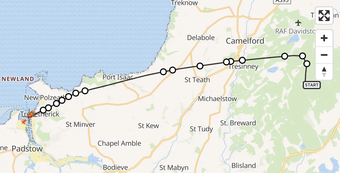
On Monday, 9 March 2026 at 15:24, a Coastguard Helicopter departed from St. Breward to Trebetherick. It was the Coastguard Helicopter with registration number G-MCGF. The flight lasted 14 minutes. During that period, the aircraft travelled 17 miles at an average speed of 72 miles per hour at a maximum altitude of 1275 feet.
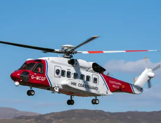
Helicopter: G-MCGF
The helicopter G-MCGF is used by the British Coastguard. The helicopter is deployed in search and rescue operations at sea, rescue operations involving ships or drilling platforms, patrols to prevent smuggling or piracy, environmental monitoring and disaster relief support.
Photo: The Carlisle Kid
17 miles
1275 feet
72 mph
15 minutes
15:24
15:38

Route
Daymer Lane, Trebetherick15:38
Trebetherick, Trebetherick15:37
Polzeath, Polzeath15:36
New Polzeath, New Polzeath15:36
Polzeath, Polzeath15:36
St. Minver Highlands, St. Minver Highlands15:36
St Minver, St Minver15:35
St. Minver Highlands, St. Minver Highlands15:35
Port Isaac, Port Isaac15:33
St. Teath, St. Teath15:32
St Teath, St Teath15:32
Helstone, Helstone15:31
Michaelstow, Michaelstow15:31
Tresinney, Tresinney15:30
Camelford, Camelford15:29
St. Breward, St. Breward15:29
Davidstow, Davidstow15:28
St. Breward, St. Breward15:24
St. Breward, St. Breward15:24
Today
Flights Trebetherick
Coastguard Helicopter to New Polzeath19 Apr 17:39
Coastguard Helicopter to Trebetherick19 Apr 17:07
Coastguard Helicopter to Trebetherick4 Apr 21:17
Helicopter flights on your website?
You can easily display helicopter flights on your own website. Use the embed code.
