Air Ambulance Helicopter to Newcastle Royal Victoria Infirmary
Saturday, 7 March 2026 | 11:57 | From Consett
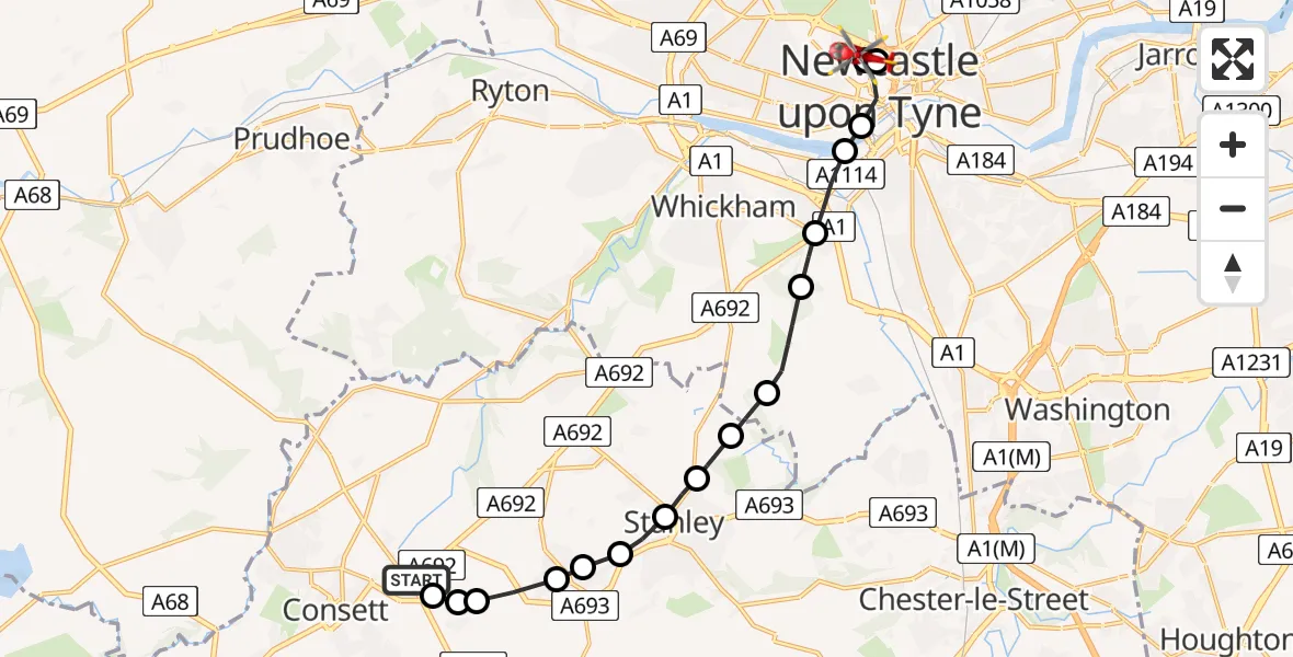
On Saturday, 7 March 2026 at 11:57, a Air Ambulance Helicopter departed from Consett to Newcastle Royal Victoria Infirmary. It was the Air Ambulance Helicopter with registration number G-NHAE. The flight lasted 10 minutes. During that period, the aircraft travelled 13 miles at an average speed of 84 miles per hour at a maximum altitude of 1475 feet.

Helicopter: G-NHAE
The helicopter G-NHAE is used as a air ambulance helicopter. The main purpose of this aircraft is to transport a Mobile Medical Team to an incident as quickly as possible, enabling the trauma doctor to provide immediate first aid on site. The aircraft is flying this flight as Air Ambulance Helicopter.
Photo: Michael Earnshaw
14 miles
1475 feet
84 mph
10 minutes
11:57
12:07

Route
Newcastle Royal Victoria Infirmary, Newcastle upon Tyne12:07
Newcastle upon Tyne, North East12:06
Newcastle Royal Victoria Infirmary, Newcastle upon Tyne12:05
Newcastle Royal Victoria Infirmary, Newcastle upon Tyne12:04
Newcastle upon Tyne, North East12:03
Gateshead, North East12:03
Whickham, North East12:02
Lamesley, Whickham12:02
Lamesley, Gateshead12:01
Stanley, North East12:00
No Place, Stanley12:00
Tanfield Lea, Stanley11:59
New Kyo, Stanley11:59
Annfield Plain, Stanley11:59
Stanley, North East11:58
Greencroft, Stanley11:58
Delves Lane, North East11:58
Leadgate, North East11:57
St Ives' Road, North East11:57
Live flights
Today
Flights Consett
Air Ambulance Helicopter to Consett17 Jun 17:45
Police Helicopter to Consett15 Jun 13:49
Police Helicopter to Leadgate, Leadgate Bypass29 May 10:35
Police Helicopter to Castleside, Consett29 May 10:21
Police Helicopter to Castleside, Kent Gardens29 May 10:18
Police Helicopter to Consett, Consett Road29 May 09:44
Air Ambulance Helicopter to Consett, A69121 May 17:37
Police Helicopter to Dinnington, Dinnington Road28 Mar 20:24
Helicopter flights on your website?
You can easily display helicopter flights on your own website. Use the embed code.
