Police Helicopter to Redhill Aerodrome
Saturday, 7 March 2026 | 11:26 | From Horley
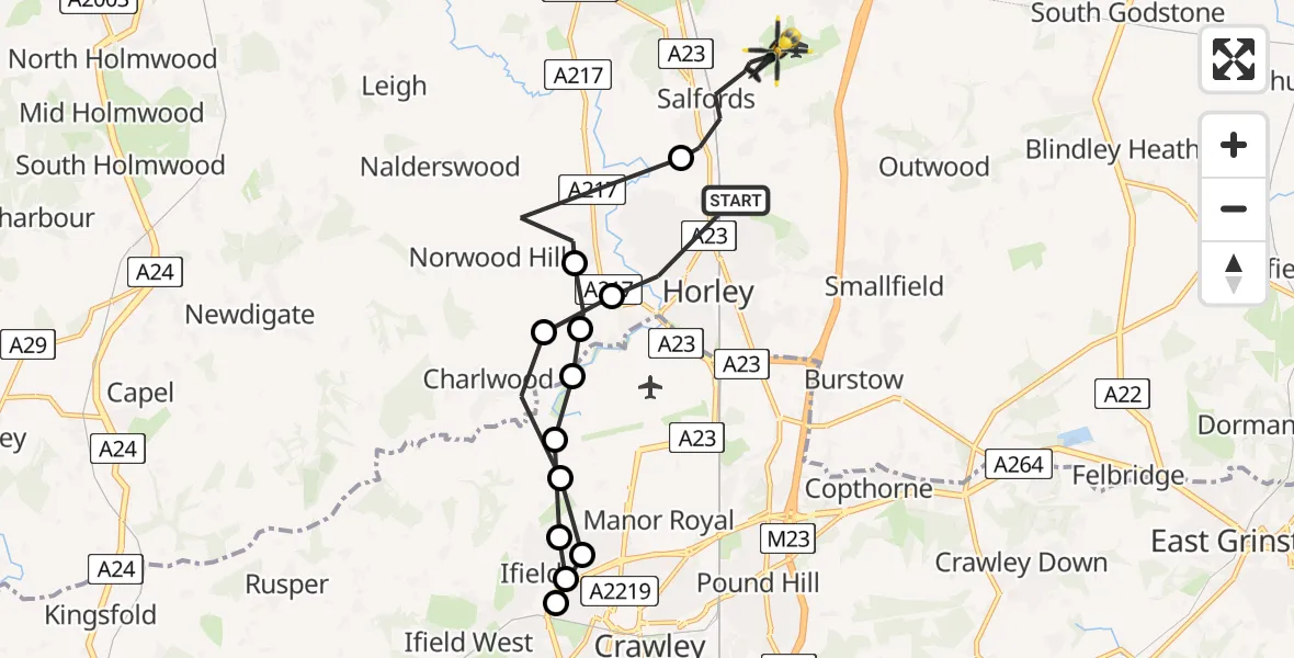
On Saturday, 7 March 2026 at 11:26, a Police Helicopter departed from Horley to Redhill Aerodrome. It was the Police Helicopter with registration number G-POLH. The flight lasted 11 minutes. During that period, the aircraft travelled 16 miles at an average speed of 88 miles per hour at a maximum altitude of 300 feet.
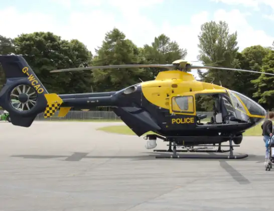
Helicopter: G-POLH
The helicopter G-POLH is used by the British police. The helicopter is deployed in pursuits, missing persons cases and other incidents where a helicopter provides added value.
Photo: Arpingstone
16 miles
300 feet
88 mph
11 minutes
11:26
11:37

Route
Redhill Aerodrome, Redhill, Surrey11:37
Salfords, Reigate and Banstead11:35
Norwood Hill, Reigate and Banstead11:34
Hookwood, Mole Valley11:34
Charlwood, Mole Valley11:33
London Gatwick Airport, London11:33
Langley Green, Crawley11:31
Ifield, Crawley11:30
West Green, Crawley11:30
Langley Green, Crawley11:29
Crawley, Crawley11:29
Charlwood, Mole Valley11:28
Hookwood, Mole Valley11:27
Orchard Drive, Reigate and Banstead11:26
Live flights
Today
Flights Horley
Police Helicopter to Selsey, Merryfield Drive30 May 11:50
Police Helicopter to Horley, Brookfield Drive17 May 20:00
Police Helicopter to Horley, Cross Oak Lane13 May 19:39
Police Helicopter to Horley, Cross Oak Lane13 May 01:28
Police Helicopter to Horley31 Mar 16:12
Helicopter flights on your website?
You can easily display helicopter flights on your own website. Use the embed code.
