Police Helicopter to Newcastle International Airport
Saturday, 7 March 2026 | 2:23 | From Hutton Henry
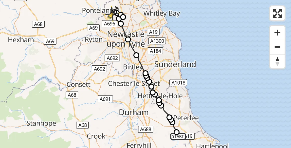
On Saturday, 7 March 2026 at 2:23, a Police Helicopter departed from Hutton Henry to Newcastle International Airport. It was the Police Helicopter with registration number G-POLA. The flight lasted 13 minutes. During that period, the aircraft travelled 32 miles at an average speed of 151 miles per hour at a maximum altitude of 1325 feet.
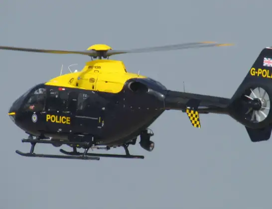
Helicopter: G-POLA
The helicopter G-POLA is used by the British police. The helicopter is deployed in pursuits, missing persons cases and other incidents where a helicopter provides added value.
Photo: ozz13x
32 miles
1325 feet
151 mph
13 minutes
02:23
02:36

Route
Newcastle International Airport, Newcastle upon Tyne, Tyne and Wear02:36
Hazlerigg Village, Newcastle upon Tyne02:36
Dinnington, Newcastle upon Tyne02:36
Hazlerigg Village, Newcastle upon Tyne02:36
Dinnington, Newcastle upon Tyne02:35
Hazlerigg Village, Newcastle upon Tyne02:35
Newcastle upon Tyne, Newcastle upon Tyne02:34
Newcastle upon Tyne, North East02:33
Gateshead, North East02:31
Washington, Sunderland02:29
Penshaw, Sunderland02:29
Chester-le-Street, North East02:29
Houghton-le-Spring, Sunderland02:29
High Dubmire, Sunderland02:28
Chilton Moor, Sunderland02:28
East Rainton, Sunderland02:27
Hetton-le-Hole, Sunderland02:27
Littletown, Sunderland02:27
Pittington, North East02:26
Haswell, North East02:25
Wheatley Hill, North East02:25
Greenhills Farm Airstrip, Durham, County Durham02:25
Wingate, North East02:24
Castle Eden Walkway, North East02:23
Live flights
Today
Helicopter flights on your website?
You can easily display helicopter flights on your own website. Use the embed code.
