Air Ambulance Helicopter to Great Musgrave, Swillings Lane
Friday, 6 March 2026 | 17:45 | From Culgaith
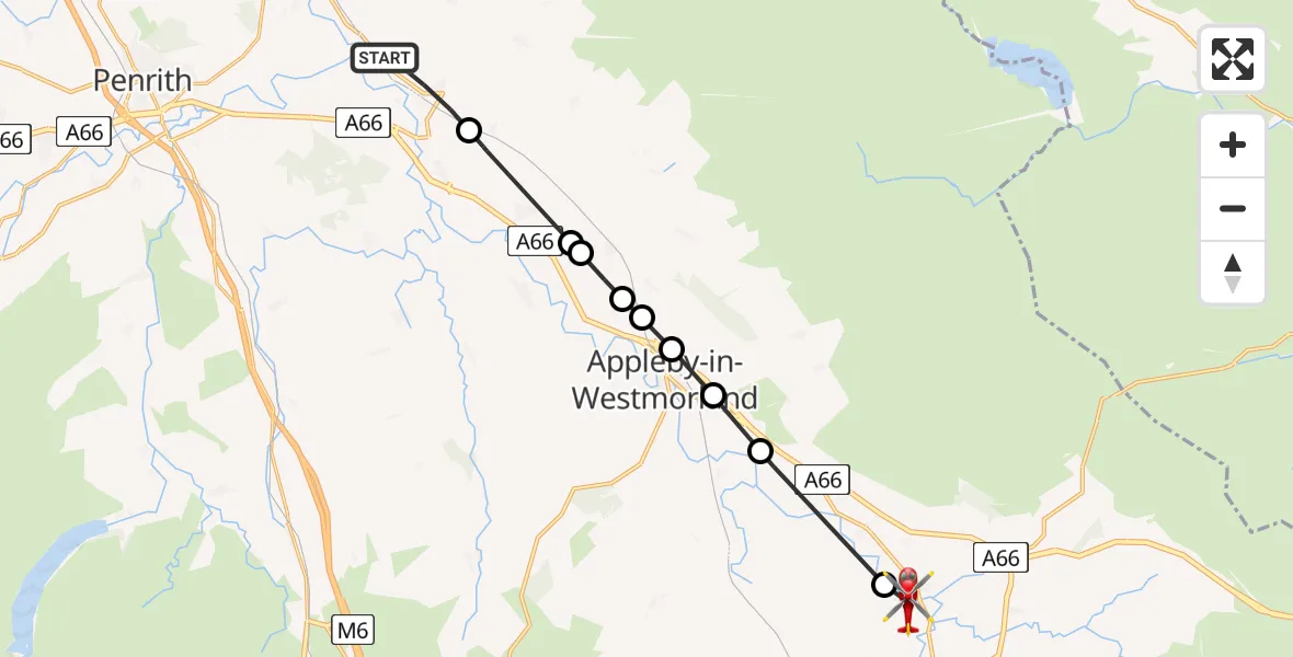
On Friday, 6 March 2026 at 17:45, a Air Ambulance Helicopter departed from Culgaith to Great Musgrave. It was the Air Ambulance Helicopter with registration number G-NHAE. The flight lasted 6 minutes. During that period, the aircraft travelled 15 miles at an average speed of 160 miles per hour at a maximum altitude of 3375 feet.
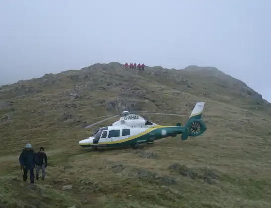
Helicopter: G-NHAE
The helicopter G-NHAE is used as a air ambulance helicopter. The main purpose of this aircraft is to transport a Mobile Medical Team to an incident as quickly as possible, enabling the trauma doctor to provide immediate first aid on site. The aircraft is flying this flight as Air Ambulance Helicopter.
Photo: Michael Earnshaw
16 miles
3375 feet
160 mph
6 minutes
17:45
17:51

Route
Swillings Lane, Great Musgrave17:51
Great Musgrave, Great Musgrave17:51
Warcop, Warcop17:49
Murton, Murton17:49
Appleby-in-Westmorland, Appleby-in-Westmorland17:48
Crackenthorpe, Crackenthorpe17:48
Brampton, Brampton17:48
Long Marton, Long Marton17:47
Kirkby Thore, Kirkby Thore17:47
Newbiggin, Newbiggin17:46
Culgaith, Culgaith17:45
Live flights
Today
Police Helicopter to Glasgow, South Street6 Jul 23:22
Police Helicopter to South Lanarkshire6 Jul 23:09
Police Helicopter to North Weald Airfield6 Jul 22:57
Police Aircraft to East Midlands Airport6 Jul 22:56
Police Helicopter to Lochhead, A726 Jul 22:39
Flights Culgaith
Air Ambulance Helicopter to Alston Moor27 Jun 13:25
Air Ambulance Helicopter to Skirwith25 May 11:06
Air Ambulance Helicopter to Culgaith, B641221 May 13:28
Air Ambulance Helicopter to Stanhope10 May 17:59
Air Ambulance Helicopter to Bolton, Whyber Lane25 Apr 11:49
Air Ambulance Helicopter to Culgaith, B641224 Apr 19:18
Air Ambulance Helicopter to Culgaith, B641224 Apr 11:45
Helicopter flights on your website?
You can easily display helicopter flights on your own website. Use the embed code.
