Air Ambulance Helicopter to Mansfield Woodhouse, Farmway
Friday, 6 March 2026 | 13:42 | From Hickling
On Friday, 6 March 2026 at 13:42, a Air Ambulance Helicopter departed from Hickling to Mansfield Woodhouse. It was the Air Ambulance Helicopter with registration number G-DRLA. The flight lasted 13 minutes. During that period, the aircraft travelled 26 miles at an average speed of 123 miles per hour at a maximum altitude of 900 feet.
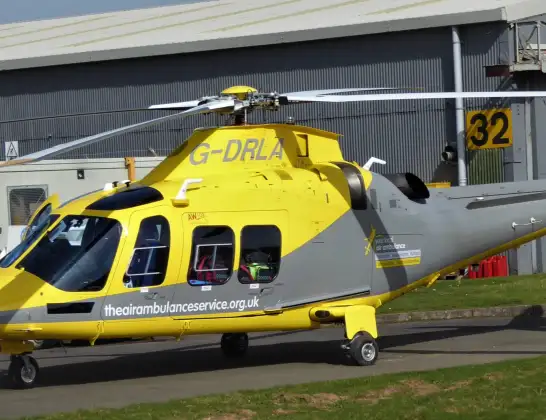
Helicopter: G-DRLA
The helicopter G-DRLA is used as an ambulance helicopter. The helicopter is equipped with a stretcher for transporting patients. The helicopter is often used to transport to hospitals.
Photo: Alec Wilson
26 miles
900 feet
123 mph
13 minutes
13:42
13:54

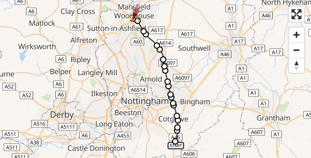
Route
Farmway, East Midlands13:54
Mansfield Woodhouse, East Midlands13:51
Mansfield, East Midlands13:50
Newark and Sherwood, East Midlands13:50
Blidworth CP, Newark and Sherwood13:49
Calverton CP, Gedling13:48
Oxton CP, Newark and Sherwood13:48
Calverton CP, Gedling13:47
Woodborough, Gedling13:47
Lambley, Gedling13:46
Burton Joyce, Gedling13:46
Stoke Bardolph, Netherfield13:45
Stoke Bardolph, Netherfield13:45
Radcliffe on Trent, Rushcliffe13:45
Radcliffe on Trent, City of Nottingham13:45
Cotgrave, Rushcliffe13:44
Rushcliffe, East Midlands13:44
Owthorpe, Rushcliffe13:43
Cotgrave, Rushcliffe13:43
Kinoulton, Rushcliffe13:42
Melton Road, Rushcliffe13:42
Live flights
Today
Police Helicopter to Glasgow, South Street6 Jul 23:22
Police Helicopter to South Lanarkshire6 Jul 23:09
Police Helicopter to North Weald Airfield6 Jul 22:57
Police Aircraft to East Midlands Airport6 Jul 22:56
Police Helicopter to Lochhead, A726 Jul 22:39
Flights Hickling
Air Ambulance Helicopter to Hickling, A466 Jul 14:14
Air Ambulance Helicopter to Hickling, A466 Jul 09:02
Air Ambulance Helicopter to Hickling, A464 Jul 15:39
Air Ambulance Helicopter to Nottingham Heliport30 Jun 15:14
Air Ambulance Helicopter to Gunness, Trent Side26 Jun 06:43
Helicopter flights on your website?
You can easily display helicopter flights on your own website. Use the embed code.
