Air Ambulance Helicopter to Tandridge, Moats Lane
Thursday, 5 March 2026 | 21:41 | From South Nutfield
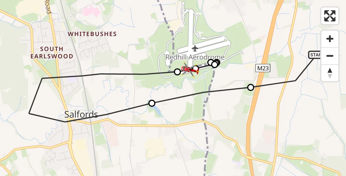
On Thursday, 5 March 2026 at 21:41, a Air Ambulance Helicopter departed from South Nutfield to Tandridge. It was the Air Ambulance Helicopter with registration number G-KSSC. The flight lasted 8 minutes. During that period, the aircraft travelled 5 miles at an average speed of 39 miles per hour at a maximum altitude of 975 feet.
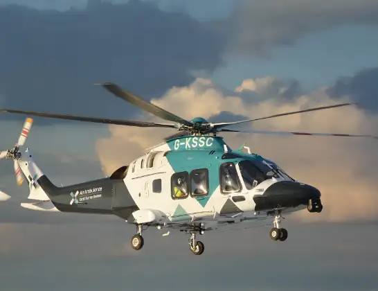
Helicopter: G-KSSC
The helicopter G-KSSC is used as a air ambulance helicopter. The main purpose of this aircraft is to transport a Mobile Medical Team to an incident as quickly as possible, enabling the trauma doctor to provide immediate first aid on site. The aircraft is flying this flight as Air Ambulance Helicopter.
Photo: Shona aakss
6 miles
975 feet
39 mph
9 minutes
21:41
21:50

Route
Moats Lane, 21:50
Tandridge21:48
Redhill Aerodrome, Redhill, Surrey21:48
Tandridge21:46
Redhill Aerodrome, Redhill, Surrey21:46
Tandridge21:45
Redhill Aerodrome, Redhill, Surrey21:44
Salfords, Reigate and Banstead21:42
Tandridge21:42
Coopers Hill Road, 21:41
Live flights
Today
Flights Tandridge
Police Helicopter to Salfords, Cross Oak Lane31 May 19:55
Helicopter flights on your website?
You can easily display helicopter flights on your own website. Use the embed code.
