Coastguard Helicopter to Glenegedale, High Road
Thursday, 5 March 2026 | 18:04 | From Glasgow Prestwick Airport
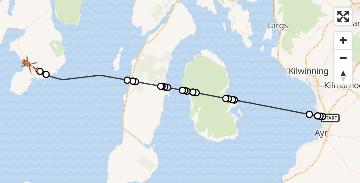
On Thursday, 5 March 2026 at 18:04, a Coastguard Helicopter departed from Glasgow Prestwick Airport to Glenegedale. It was the Coastguard Helicopter with registration number G-MCGP. The flight lasted 34 minutes. During that period, the aircraft travelled 66 miles at an average speed of 115 miles per hour at a maximum altitude of 1625 feet.
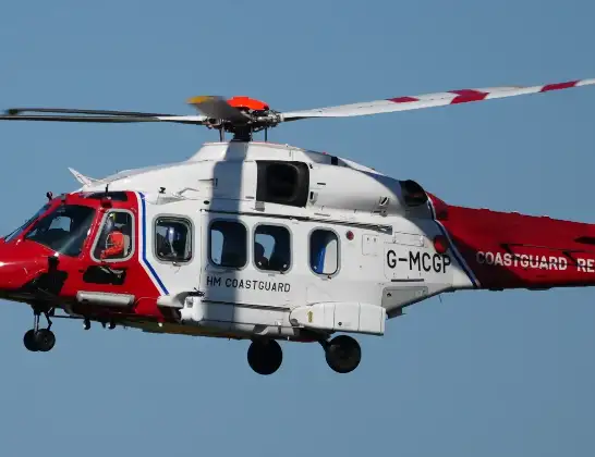
Helicopter: G-MCGP
The helicopter G-MCGP is used by the British Coastguard. The helicopter is deployed in search and rescue operations at sea, rescue operations involving ships or drilling platforms, patrols to prevent smuggling or piracy, environmental monitoring and disaster relief support.
Photo: Jonathan Payne
66 miles
1625 feet
115 mph
35 minutes
18:04
18:38

Route
High Road, 18:38
Port Ellen18:37
Lagavulin18:36
Inner Seas18:29
Muasdale18:29
Tayinloan18:29
Bridgend18:26
Carradale18:26
Bridgend18:26
Carradale18:26
Inner Seas18:24
Dougarie18:24
Balliekine18:24
Auchencar18:23
Druid18:23
Brodick18:20
Lamlash18:20
North Corriegills18:20
Prospecthill18:20
Inner Seas18:13
Troon18:12
Monkton18:12
Prestwick18:11
Glasgow Prestwick Airport, Prestwick, South Ayrshire18:11
Glasgow Prestwick Airport, Prestwick, South Ayrshire18:04
Live flights
Today
Flights Glenegedale
Air Ambulance Aircraft to Glasgow Airport9 Jul 01:57
Coastguard Helicopter to Glasgow Airport7 Jul 17:12
Coastguard Helicopter to Glenegedale26 Jun 12:17
Air Ambulance Aircraft to Glasgow Airport28 May 23:31
Air Ambulance Aircraft to Glasgow Airport8 Apr 21:33
Helicopter flights on your website?
You can easily display helicopter flights on your own website. Use the embed code.
