Air Ambulance Helicopter to Redditch, Neighbrook Close
Thursday, 5 March 2026 | 17:26 | From Hill Croome
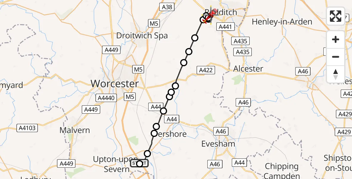
On Thursday, 5 March 2026 at 17:26, a Air Ambulance Helicopter departed from Hill Croome to Redditch. It was the Air Ambulance Helicopter with registration number G-OMAA. The flight lasted 10 minutes. During that period, the aircraft travelled 20 miles at an average speed of 129 miles per hour at a maximum altitude of 1525 feet.
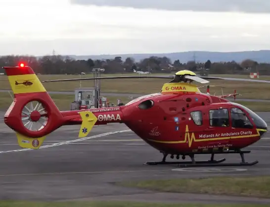
Helicopter: G-OMAA
The helicopter G-OMAA is used as a air ambulance helicopter. The main purpose of this aircraft is to transport a Mobile Medical Team to an incident as quickly as possible, enabling the trauma doctor to provide immediate first aid on site. The aircraft is flying this flight as Air Ambulance Helicopter.
Photo: James from Cheltenham, Gloucestershire
21 miles
1525 feet
129 mph
10 minutes
17:26
17:35

Route
Redditch17:35
Neighbrook Close, 17:35
Callow Hill, Redditch17:35
Redditch17:34
Upper Bentley, Bromsgrove17:33
Feckenham, Redditch17:33
Wychavon17:32
Hanbury, Wychavon17:31
Wychavon17:30
Upton Snodsbury, Wychavon17:30
Naunton Beauchamp, Wychavon17:30
Peopleton, Wychavon17:29
Drakes Broughton, Wychavon17:28
Wychavon17:28
Defford, Wychavon17:27
M5, Wychavon17:26
Upper Strensham, Wychavon17:26
Hill Croome, Malvern Hills17:26
Live flights
Today
Police Helicopter to Glasgow, South Street6 Jul 23:22
Police Helicopter to South Lanarkshire6 Jul 23:09
Police Helicopter to North Weald Airfield6 Jul 22:57
Police Aircraft to East Midlands Airport6 Jul 22:56
Police Helicopter to Lochhead, A726 Jul 22:39
Flights Redditch
Air Ambulance Helicopter to Redditch15 May 16:29
Air Ambulance Helicopter to Hill Croome, M513 Apr 10:44
Air Ambulance Helicopter to Upper Strensham, M527 Mar 18:15
Air Ambulance Helicopter to Redditch27 Mar 17:50
Air Ambulance Helicopter to Kinnersley, M525 Mar 10:43
Helicopter flights on your website?
You can easily display helicopter flights on your own website. Use the embed code.
