Air Ambulance Helicopter to Bridge Yate, High Street
Thursday, 5 March 2026 | 16:35 | From Almondsbury Helicopter Base
On Thursday, 5 March 2026 at 16:35, a Air Ambulance Helicopter departed from Almondsbury Helicopter Base to Bridge Yate. It was the Air Ambulance Helicopter with registration number G-GWAC. The flight lasted 7 minutes. During that period, the aircraft travelled 12 miles at an average speed of 100 miles per hour at a maximum altitude of 925 feet.
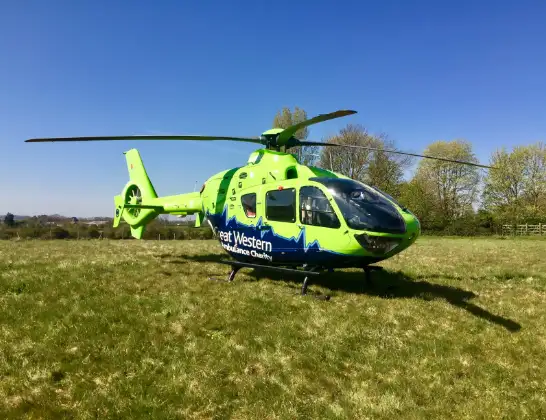
Helicopter: G-GWAC
The helicopter G-GWAC is used as a air ambulance helicopter. The main purpose of this aircraft is to transport a Mobile Medical Team to an incident as quickly as possible, enabling the trauma doctor to provide immediate first aid on site. The aircraft is flying this flight as Air Ambulance Helicopter.
Photo: Mojo0306
13 miles
925 feet
100 mph
8 minutes
16:35
16:42

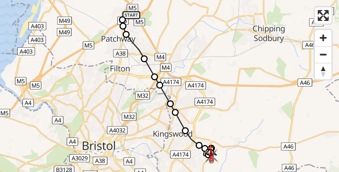
Route
High Street, West of England16:42
Bridge Yate, West of England16:42
Warmley, West of England16:42
Cann Lane, West of England16:41
Cann Lane, West of England16:41
Bridge Yate, Bristol16:41
Bridge Yate, West of England16:40
Warmley, Bristol16:40
Bridge Yate, Bristol16:39
Warmley, West of England16:39
Warmley, Bristol16:38
Bristol, West of England16:38
Kingswood, West of England16:38
Bristol, West of England16:37
Harry Stoke, West of England16:37
Harry Stoke, Bristol16:36
Bristol, West of England16:36
Patchway, West of England16:35
Almondsbury, West of England16:35
Almondsbury Helicopter Base, Bristol, Somerset16:35
Live flights
Today
Helicopter flights on your website?
You can easily display helicopter flights on your own website. Use the embed code.
