Air Ambulance Helicopter to Poole, Whitecliff Road
Thursday, 5 March 2026 | 13:52 | From RNAS Portland Heliport
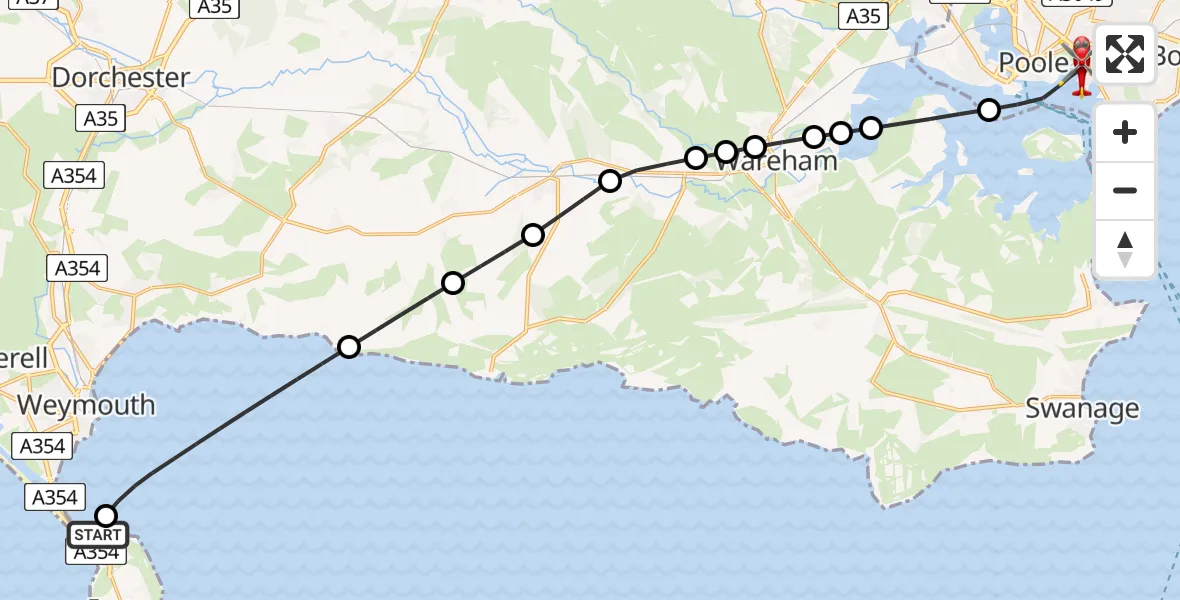
On Thursday, 5 March 2026 at 13:52, a Air Ambulance Helicopter departed from RNAS Portland Heliport to Poole. It was the Air Ambulance Helicopter with registration number G-DSAA. The flight lasted 11 minutes. During that period, the aircraft travelled 24 miles at an average speed of 135 miles per hour at a maximum altitude of 1200 feet.
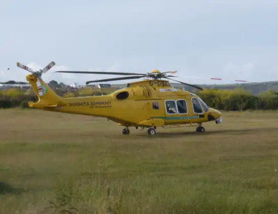
Helicopter: G-DSAA
The helicopter G-DSAA is used as a air ambulance helicopter. The main purpose of this aircraft is to transport a Mobile Medical Team to an incident as quickly as possible, enabling the trauma doctor to provide immediate first aid on site. The aircraft is flying this flight as Air Ambulance Helicopter.
Photo: Andrew Bone
25 miles
1200 feet
135 mph
11 minutes
13:52
14:03

Route
Poole14:03
Whitecliff Road, 14:03
Poole14:01
Arne14:00
Wareham St. Martin14:00
Wareham Town13:59
Wareham13:59
Wareham Town13:59
Wareham13:58
East Stoke13:58
Wool13:57
Winfrith Newburgh13:56
Chaldon Herring13:55
English Channel, 13:53
English Channel13:52
RNAS Portland Heliport, Portland13:52
Live flights
Today
Flights Poole
Coastguard Helicopter to Poole, Whitecliff Road28 Jun 12:47
Coastguard Helicopter to Poole, Whitecliff Road28 Jun 12:05
Coastguard Helicopter to Poole, Whitecliff Road28 Jun 11:46
Coastguard Helicopter to Poole, Whitecliff Road28 Jun 11:07
Coastguard Helicopter to Solent Airport30 May 21:16
Helicopter flights on your website?
You can easily display helicopter flights on your own website. Use the embed code.
