Air Ambulance Helicopter to RNAS Portland Heliport
Thursday, 5 March 2026 | 13:02 | From Lytchett Matravers
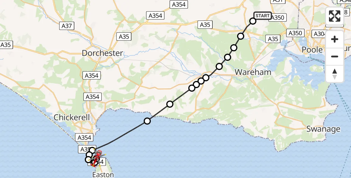
On Thursday, 5 March 2026 at 13:02, a Air Ambulance Helicopter departed from Lytchett Matravers to RNAS Portland Heliport. It was the Air Ambulance Helicopter with registration number G-DSAA. The flight lasted 12 minutes. During that period, the aircraft travelled 23 miles at an average speed of 119 miles per hour at a maximum altitude of 1500 feet.
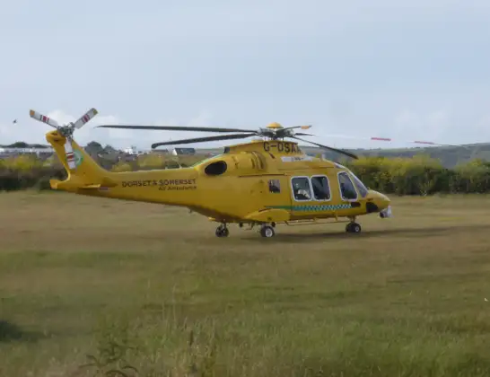
Helicopter: G-DSAA
The helicopter G-DSAA is used as a air ambulance helicopter. The main purpose of this aircraft is to transport a Mobile Medical Team to an incident as quickly as possible, enabling the trauma doctor to provide immediate first aid on site. The aircraft is flying this flight as Air Ambulance Helicopter.
Photo: Andrew Bone
24 miles
1500 feet
119 mph
12 minutes
13:02
13:14

Route
RNAS Portland Heliport, Portland13:14
RNAS Portland Heliport, Portland13:14
Chiswell13:13
English Channel13:13
Chiswell13:12
Castletown13:12
English Channel13:09
Chaldon Herring13:08
Winfrith Newburgh13:07
Wool13:07
Wareham13:06
Wool13:06
East Stoke13:05
Wareham St. Martin13:05
Wareham13:04
Bloxworth13:04
Morden13:03
Colehill Road, 13:02
Live flights
Police Helicopter on its way from Dundrod12 Jul 22:50
Today
Police Helicopter to East Ardsley, Stoney Lane12 Jul 23:51
Police Helicopter to Birmingham Airport12 Jul 23:46
Air Ambulance Helicopter to Newlands of Culloden12 Jul 23:24
Helicopter flights on your website?
You can easily display helicopter flights on your own website. Use the embed code.
