Air Ambulance Helicopter to Kendal, Windermere Road
Wednesday, 4 March 2026 | 12:52 | From Langwathby
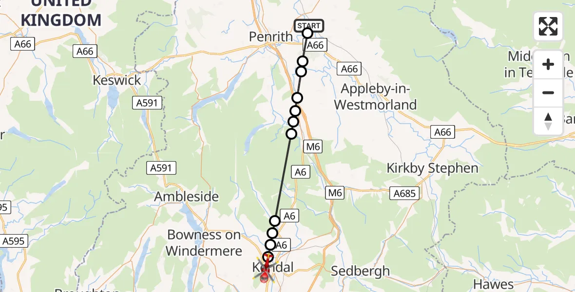
On Wednesday, 4 March 2026 at 12:52, a Air Ambulance Helicopter departed from Langwathby to Kendal. It was the Air Ambulance Helicopter with registration number G-NHAE. The flight lasted 10 minutes. During that period, the aircraft travelled 25 miles at an average speed of 145 miles per hour at a maximum altitude of 1825 feet.
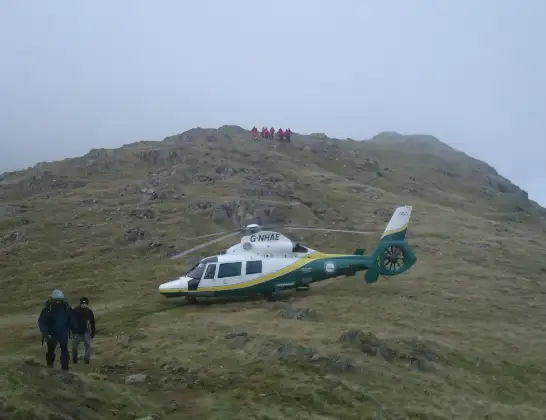
Helicopter: G-NHAE
The helicopter G-NHAE is used as a air ambulance helicopter. The main purpose of this aircraft is to transport a Mobile Medical Team to an incident as quickly as possible, enabling the trauma doctor to provide immediate first aid on site. The aircraft is flying this flight as Air Ambulance Helicopter.
Photo: Michael Earnshaw
25 miles
1825 feet
145 mph
11 minutes
12:52
13:03

Route
Windermere Road, 13:03
Kendal13:02
Burneside13:02
Bowston13:01
Garnett Bridge13:01
Keld12:57
Bampton Grange12:57
Rosgill12:56
Little Strickland12:56
Great Strickland12:55
Melkinthorpe12:54
Brougham12:53
B6412, 12:52
Live flights
Today
Flights Kendal
Air Ambulance Helicopter to Langwathby, B641222 May 10:57
Air Ambulance Helicopter to Kendal, Jenkin Rise22 May 10:40
Air Ambulance Helicopter to Kendal, Jenkin Rise17 May 18:14
Air Ambulance Helicopter to Kendal, Castle Drive16 Apr 16:45
Flights Langwathby
Air Ambulance Helicopter to Newby22 Jun 12:09
Air Ambulance Helicopter to Langwathby, B641220 Jun 19:07
Air Ambulance Helicopter to Langwathby, B641220 Jun 16:13
Air Ambulance Helicopter to Langwathby, B641217 Jun 13:27
Air Ambulance Helicopter to Langwathby, B641215 Jun 12:50
Air Ambulance Helicopter to Langwathby, B641214 Jun 13:12
Air Ambulance Helicopter to Langwathby, B641211 Jun 14:26
Helicopter flights on your website?
You can easily display helicopter flights on your own website. Use the embed code.
