Air Ambulance Helicopter to Longnewton, A67
Wednesday, 4 March 2026 | 8:01 | From Teesside International Airport
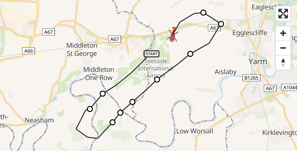
On Wednesday, 4 March 2026 at 8:01, a Air Ambulance Helicopter departed from Teesside International Airport to Longnewton. It was the Air Ambulance Helicopter with registration number G-NHAE. The flight lasted 11 minutes. During that period, the aircraft travelled 9 miles at an average speed of 52 miles per hour at a maximum altitude of 675 feet.
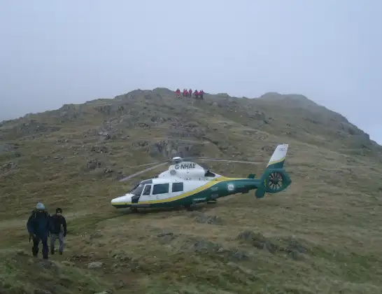
Helicopter: G-NHAE
The helicopter G-NHAE is used as a air ambulance helicopter. The main purpose of this aircraft is to transport a Mobile Medical Team to an incident as quickly as possible, enabling the trauma doctor to provide immediate first aid on site. The aircraft is flying this flight as Air Ambulance Helicopter.
Photo: Michael Earnshaw
10 miles
675 feet
52 mph
12 minutes
08:01
08:12

Route
A67, Tees Valley08:12
Longnewton, Tees Valley08:11
Egglescliffe, Tees Valley08:11
Aislaby, Tees Valley08:10
Newsham, Tees Valley08:10
Aislaby, Tees Valley08:09
Middleton One Row, Tees Valley08:09
Over Dinsdale, York and North Yorkshire08:09
Neasham, Tees Valley08:08
Over Dinsdale, York and North Yorkshire08:07
Teesside International Airport, Darlington, Durham08:01
Today
Flights Longnewton
Helicopter flights on your website?
You can easily display helicopter flights on your own website. Use the embed code.
