Police Helicopter to MOD St Athan
Wednesday, 4 March 2026 | 2:38 | From Bristol Channel
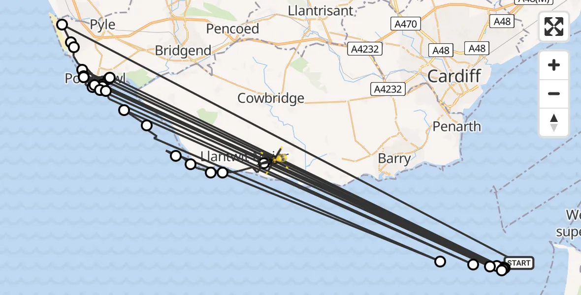
On Wednesday, 4 March 2026 at 2:38, a Police Helicopter departed from Bristol Channel to MOD St Athan. It was the Police Helicopter with registration number G-NWOI. The flight lasted 20 minutes. During that period, the aircraft travelled 484 miles at an average speed of 1455 miles per hour at a maximum altitude of 1150 feet.
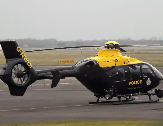
Helicopter: G-NWOI
The helicopter G-NWOI is used by the British police. The helicopter is deployed in pursuits, missing persons cases and other incidents where a helicopter provides added value.
Photo: James from Cheltenham
484 miles
1150 feet
1455 mph
20 minutes
02:38
02:58

Route
MOD St Athan, St Athan, Vale of Glamorgan02:58
Boverton02:57
Llantwit Major02:56
St Donats02:55
Marcross02:55
Monknash02:54
Bristol Channel02:53
Southerndown02:52
Ogmore-by-Sea02:52
Bristol Channel02:51
Newton02:51
Porthcawl02:51
Bristol Channel02:50
Porthcawl02:50
Bristol Channel02:49
Porthcawl02:48
Bristol Channel02:48
Porthcawl02:47
Bristol Channel02:47
Porthcawl02:46
Newton02:46
Bristol Channel02:45
Newton02:45
Porthcawl02:44
Newton02:44
Bristol Channel02:43
Newton02:43
Porthcawl02:42
Newton02:41
Porthcawl02:39
Kenfig02:39
Cornelly02:38
Bristol Channel, 02:38
Live flights
Today
Helicopter flights on your website?
You can easily display helicopter flights on your own website. Use the embed code.
