Air Ambulance Helicopter to Wyke Regis, Lessingham Avenue
Tuesday, 3 March 2026 | 13:02 | From Henstridge Airfield
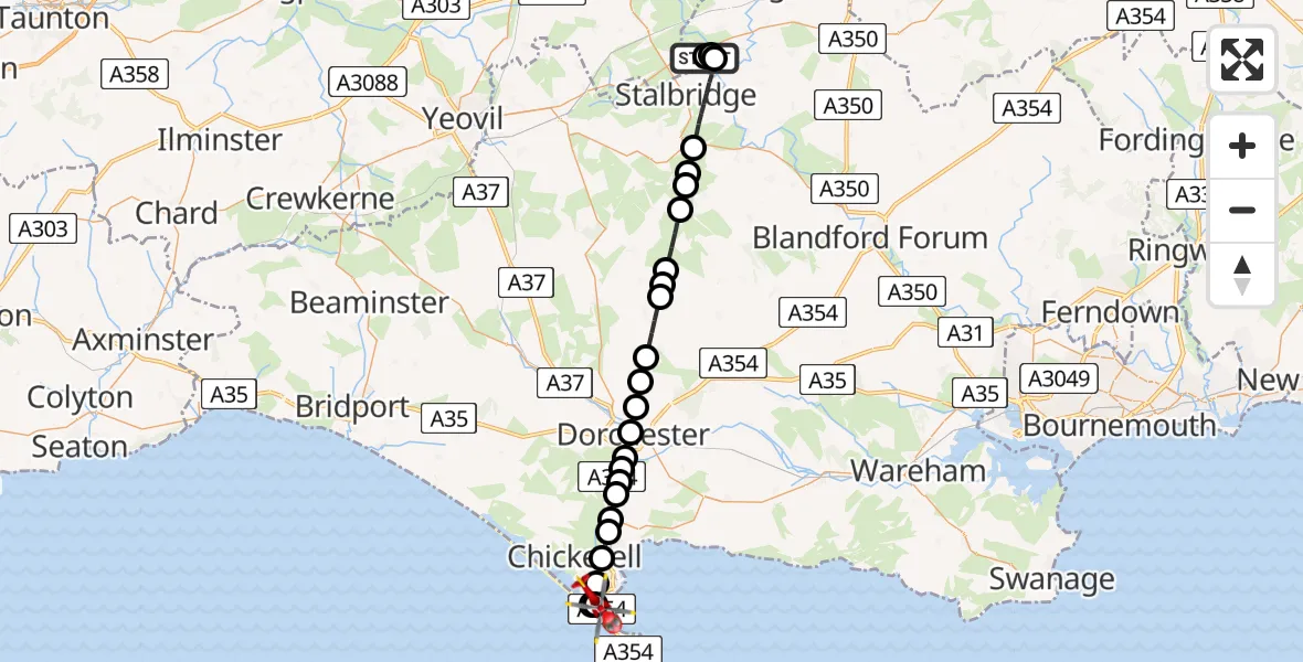
On Tuesday, 3 March 2026 at 13:02, a Air Ambulance Helicopter departed from Henstridge Airfield to Wyke Regis. It was the Air Ambulance Helicopter with registration number G-DSAA. The flight lasted 16 minutes. During that period, the aircraft travelled 31 miles at an average speed of 115 miles per hour at a maximum altitude of 1100 feet.
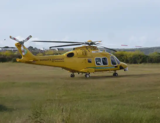
Helicopter: G-DSAA
The helicopter G-DSAA is used as a air ambulance helicopter. The main purpose of this aircraft is to transport a Mobile Medical Team to an incident as quickly as possible, enabling the trauma doctor to provide immediate first aid on site. The aircraft is flying this flight as Air Ambulance Helicopter.
Photo: Andrew Bone
31 miles
1100 feet
115 mph
16 minutes
13:02
13:18

Route
Lessingham Avenue, Weymouth13:18
Wyke Regis, Weymouth13:17
The Fleet13:17
Wyke Regis, Weymouth13:15
Weymouth13:15
Nottington, Weymouth13:14
Upwey, Weymouth13:14
Upwey13:14
Winterborne Herringston13:13
Winterborne Monkton13:13
Winterborne Herringston13:13
Dorchester13:12
Stinsford13:12
Charminster13:11
Piddlehinton13:11
Piddletrenthide13:10
Alton Pancras13:09
Piddletrenthide13:09
Mappowder13:08
Hazelbury Bryan13:07
King's Stag13:07
Lydlinch13:07
West Mill Lane, 13:05
Stalbridge13:04
Kington Magna13:04
Henstridge13:04
Henstridge Airfield, Templecombe, Somerset13:02
Live flights
Today
Helicopter flights on your website?
You can easily display helicopter flights on your own website. Use the embed code.
