Air Ambulance Helicopter to Brighton City Airport
Monday, 2 March 2026 | 16:39 | From Pevensey Bay
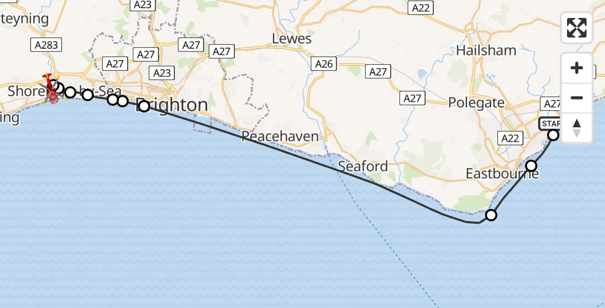
On Monday, 2 March 2026 at 16:39, a Air Ambulance Helicopter departed from Pevensey Bay to Brighton City Airport. It was the Air Ambulance Helicopter with registration number G-KSSC. The flight lasted 16 minutes. During that period, the aircraft travelled 32 miles at an average speed of 118 miles per hour at a maximum altitude of 1125 feet.
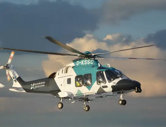
Helicopter: G-KSSC
The helicopter G-KSSC is used as a air ambulance helicopter. The main purpose of this aircraft is to transport a Mobile Medical Team to an incident as quickly as possible, enabling the trauma doctor to provide immediate first aid on site. The aircraft is flying this flight as Air Ambulance Helicopter.
Photo: Shona aakss
33 miles
1125 feet
118 mph
17 minutes
16:39
16:55

Route
Brighton City Airport, Brighton, East Sussex16:55
Brighton City Airport, Brighton, East Sussex16:54
Lancing, Shoreham-by-Sea16:54
Shoreham-by-Sea, Adur16:53
Kingston Buci, Adur16:52
Southwick, Adur16:51
Portslade by Sea, Brighton16:51
Portslade by Sea16:51
English Channel16:42
Eastbourne16:40
English Channel16:39
Timberlaine Road, Wealden16:39
Live flights
Today
Helicopter flights on your website?
You can easily display helicopter flights on your own website. Use the embed code.
