Police Helicopter to Godstone, Waterhouse Lane
Monday, 2 March 2026 | 14:59 | From Frittenden
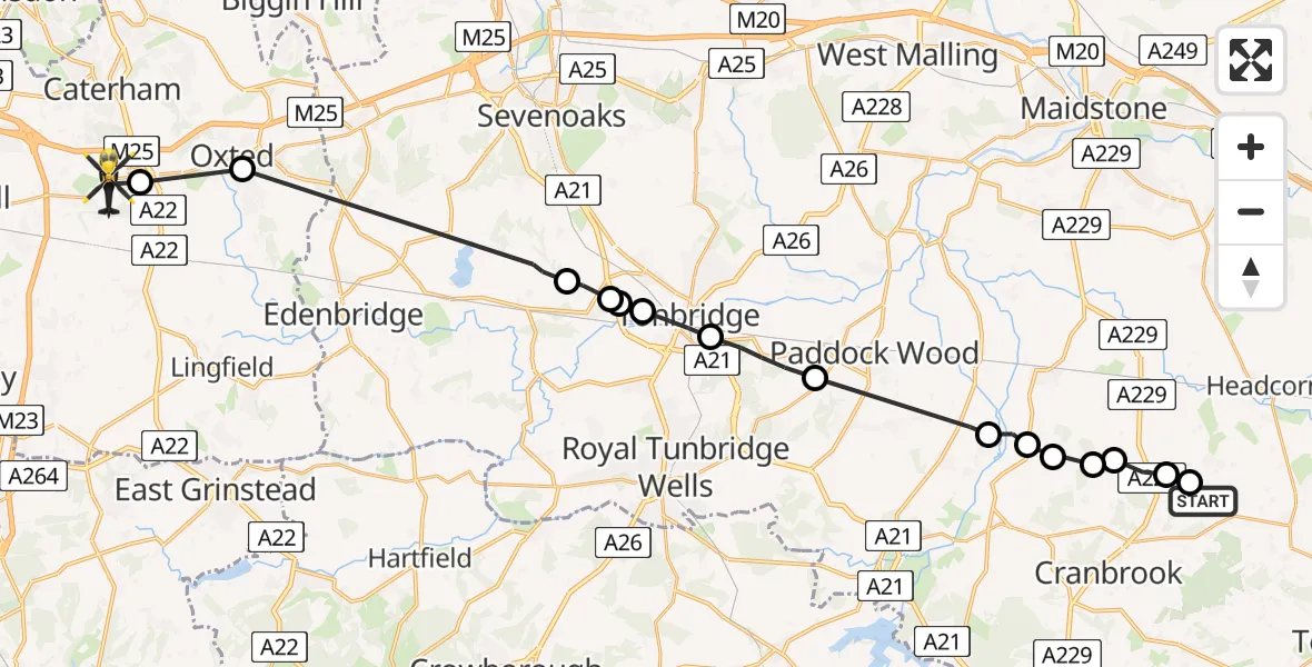
On Monday, 2 March 2026 at 14:59, a Police Helicopter departed from Frittenden to Godstone. It was the Police Helicopter with registration number G-POLH. The flight lasted 12 minutes. During that period, the aircraft travelled 31 miles at an average speed of 151 miles per hour at a maximum altitude of 1000 feet.
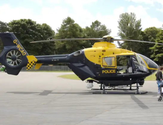
Helicopter: G-POLH
The helicopter G-POLH is used by the British police. The helicopter is deployed in pursuits, missing persons cases and other incidents where a helicopter provides added value.
Photo: Arpingstone
31 miles
1000 feet
151 mph
13 minutes
14:59
15:11

Route
Waterhouse Lane, 15:11
Godstone15:11
Limpsfield, Oxted15:10
Sevenoaks15:06
Hildenborough, Tonbridge and Malling15:05
Hildenborough, Sevenoaks15:05
Sevenoaks15:05
Tonbridge, Tonbridge and Malling15:04
Capel, Tunbridge Wells15:03
Tunbridge Wells15:01
Maidstone15:01
Tunbridge Wells15:00
Maidstone15:00
Staplehurst, Maidstone15:00
Tunbridge Wells14:59
Sissinghurst, Tunbridge Wells14:59
Sand Lane, Tunbridge Wells14:59
Live flights
Today
Flights Godstone
Police Helicopter to Godstone, M2529 Jan 12:35
Flights Frittenden
Helicopter flights on your website?
You can easily display helicopter flights on your own website. Use the embed code.
