Air Ambulance Aircraft to Old Rayne, Strathorn Road
Monday, 2 March 2026 | 13:33 | From Aberdeen International Airport
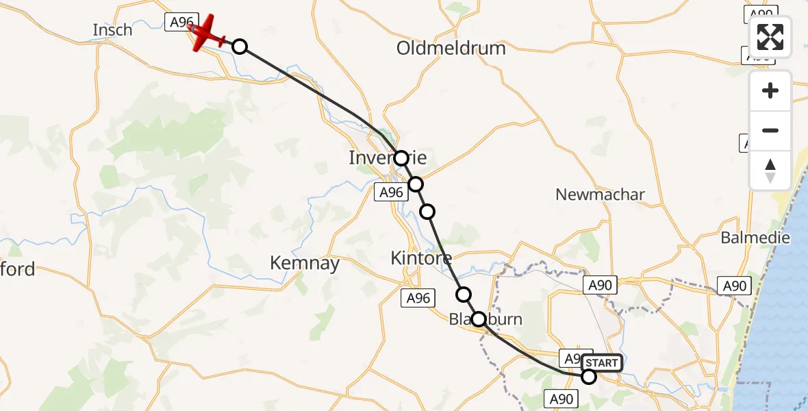
On Monday, 2 March 2026 at 13:33, a Air Ambulance Aircraft departed from Aberdeen International Airport to Old Rayne. It was the Air Ambulance Aircraft with registration number G-SASC. The flight lasted 5 minutes. During that period, the aircraft travelled 18 miles at an average speed of 215 miles per hour at a maximum altitude of 3400 feet.
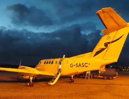
Helicopter: G-SASC
The aircraft G-SASC is used as an air ambulance aircraft. The main purpose of this aircraft is to transport a Mobile Medical Team to an incident as quickly as possible, enabling the trauma doctor to provide immediate first aid on site. The aircraft is flying this flight as Air Ambulance Aircraft.
Photo: Mike Pennington
19 miles
3400 feet
215 mph
6 minutes
13:33
13:38

Route
Strathorn Road, 13:38
Whiteford13:38
Inverurie13:36
Keithhall13:36
Inverurie13:35
Kintore13:35
Blackburn13:34
Aberdeen City13:33
Wellheads Drive, 13:33
Live flights
Today
Police Helicopter to MOD St Athan15 Jul 23:53
Police Helicopter to East Ardsley, Stoney Lane15 Jul 23:36
Helicopter flights on your website?
You can easily display helicopter flights on your own website. Use the embed code.
