Police Helicopter to Benson, Brook Street
Sunday, 1 March 2026 | 18:45 | From Barford St Michael
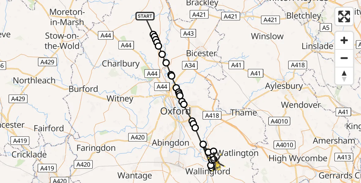
On Sunday, 1 March 2026 at 18:45, a Police Helicopter departed from Barford St Michael to Benson. It was the Police Helicopter with registration number G-POLF. The flight lasted 16 minutes. During that period, the aircraft travelled 42 miles at an average speed of 159 miles per hour at a maximum altitude of 1500 feet.
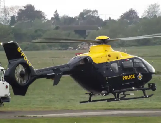
Helicopter: G-POLF
The helicopter G-POLF is used by the British police. The helicopter is deployed in pursuits, missing persons cases and other incidents where a helicopter provides added value.
Photo: James
42 miles
1500 feet
159 mph
16 minutes
18:45
19:01

Route
Brook Street, South Oxfordshire19:01
Benson, South Oxfordshire19:01
Berrick Salome, South Oxfordshire19:00
Warborough, South Oxfordshire19:00
Benson, South Oxfordshire18:59
Drayton St. Leonard, South Oxfordshire18:59
Benson, South Oxfordshire18:58
Crowmarsh Gifford, South Oxfordshire18:58
Toot Baldon, South Oxfordshire18:57
Garsington, South Oxfordshire18:57
Horspath, South Oxfordshire18:56
Oxford18:55
Marston, Oxford18:54
Elsfield, South Oxfordshire18:54
South Oxfordshire18:54
Woodeaton, South Oxfordshire18:53
Cherwell18:53
Hampton Poyle, Cherwell18:52
Bletchingdon, Cherwell18:52
Kirtlington, Cherwell18:50
Tackley, West Oxfordshire18:50
West Oxfordshire18:49
Middle Barton, West Oxfordshire18:48
West Oxfordshire18:48
Middle Barton, West Oxfordshire18:48
Duns Tew, Cherwell18:48
South Newington Road, Cherwell18:45
Live flights
Today
Police Helicopter to MOD St Athan15 Jul 23:53
Police Helicopter to East Ardsley, Stoney Lane15 Jul 23:36
Flights Benson
Air Ambulance Helicopter to Benson10 Jul 09:43
Police Helicopter to Benson, Clack's Lane2 Jul 19:06
Police Helicopter to Benson, A41301 Jul 15:27
Police Helicopter to Benson, Braze Lane1 Jul 13:48
Police Helicopter to RAF Benson30 Jun 19:42
Police Helicopter to Benson, The Sands30 Jun 15:07
Police Helicopter to Benson, The Sands28 Jun 21:41
Police Helicopter to Benson, Clack's Lane28 Jun 17:16
Police Helicopter to RAF Benson27 Jun 19:48
Helicopter flights on your website?
You can easily display helicopter flights on your own website. Use the embed code.
