Air Ambulance Helicopter to East Grinstead, Moat Road
Sunday, 1 March 2026 | 15:02 | From Redhill Aerodrome
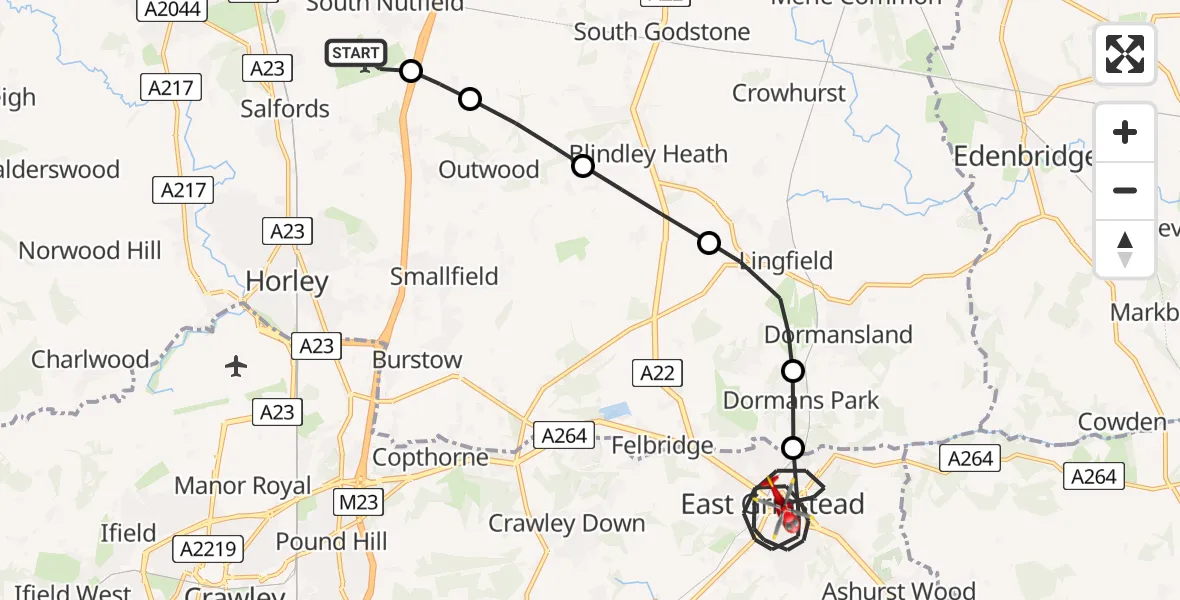
On Sunday, 1 March 2026 at 15:02, a Air Ambulance Helicopter departed from Redhill Aerodrome to East Grinstead. It was the Air Ambulance Helicopter with registration number G-LNAC. The flight lasted 10 minutes. During that period, the aircraft travelled 16 miles at an average speed of 91 miles per hour at a maximum altitude of 1100 feet.
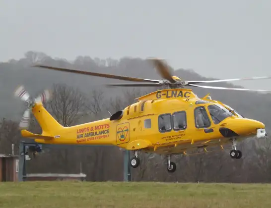
Helicopter: G-LNAC
The helicopter G-LNAC is used as a air ambulance helicopter. The main purpose of this aircraft is to transport a Mobile Medical Team to an incident as quickly as possible, enabling the trauma doctor to provide immediate first aid on site. The aircraft is flying this flight as Air Ambulance Helicopter.
Photo: James from Cheltenham, Gloucestershire
16 miles
1100 feet
91 mph
11 minutes
15:02
15:12

Route
Moat Road, Mid Sussex15:12
East Grinstead, Mid Sussex15:06
Dormans Park15:05
Lingfield15:04
Blindley Heath15:03
Outwood15:03
South Nutfield15:02
Redhill Aerodrome, Redhill, Surrey15:02
Live flights
Today
Police Helicopter to MOD St Athan15 Jul 23:53
Police Helicopter to East Ardsley, Stoney Lane15 Jul 23:36
Helicopter flights on your website?
You can easily display helicopter flights on your own website. Use the embed code.
