Air Ambulance Helicopter to Tivetshall St Mary, Rectory Road
Sunday, 1 March 2026 | 10:38 | From Norwich Airport
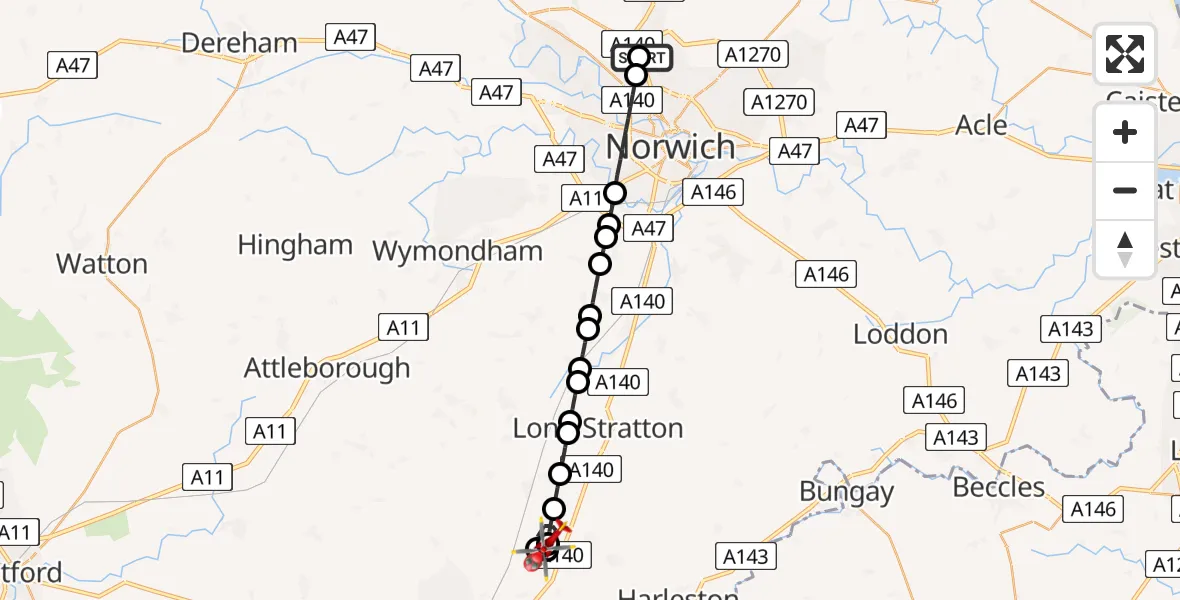
On Sunday, 1 March 2026 at 10:38, a Air Ambulance Helicopter departed from Norwich Airport to Tivetshall St Mary. It was the Air Ambulance Helicopter with registration number G-HEMC. The flight lasted 15 minutes. During that period, the aircraft travelled 20 miles at an average speed of 79 miles per hour at a maximum altitude of 975 feet.
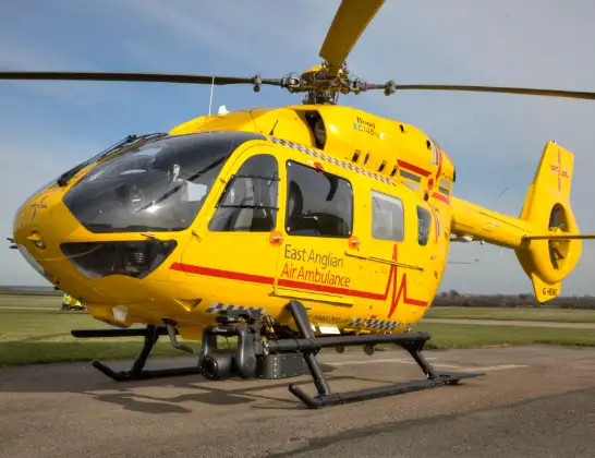
Helicopter: G-HEMC
The helicopter G-HEMC is used as a air ambulance helicopter. The main purpose of this aircraft is to transport a Mobile Medical Team to an incident as quickly as possible, enabling the trauma doctor to provide immediate first aid on site. The aircraft is flying this flight as Air Ambulance Helicopter.
Photo: Jsmauger
21 miles
975 feet
79 mph
16 minutes
10:38
10:54

Route
Rectory Road, Norwich10:54
Tivetshall St Mary, South Norfolk10:53
Tivetshall St Margaret, South Norfolk10:51
Tivetshall St Mary, South Norfolk10:51
Tivetshall St Margaret, South Norfolk10:50
Great Moulton, South Norfolk10:49
Wacton, South Norfolk10:49
South Norfolk10:48
Tharston, South Norfolk10:48
Hapton, South Norfolk10:47
Flordon, South Norfolk10:47
Bracon Ash, South Norfolk10:46
Mulbarton, South Norfolk10:45
Swardeston, South Norfolk10:45
Keswick, South Norfolk10:45
Cringleford, Norwich10:44
Norwich10:42
Broadland10:41
Norwich Airport, Norwich, Norfolk10:39
Norwich Airport, Norwich, Norfolk10:38
Live flights
Police Helicopter on its way from Wrenthorpe15 Jul 23:36
Today
Police Helicopter to MOD St Athan15 Jul 23:53
Helicopter flights on your website?
You can easily display helicopter flights on your own website. Use the embed code.
