Air Ambulance Helicopter to Trewoon, Westbridge Road
Saturday, 28 February 2026 | 11:58 | From Helston
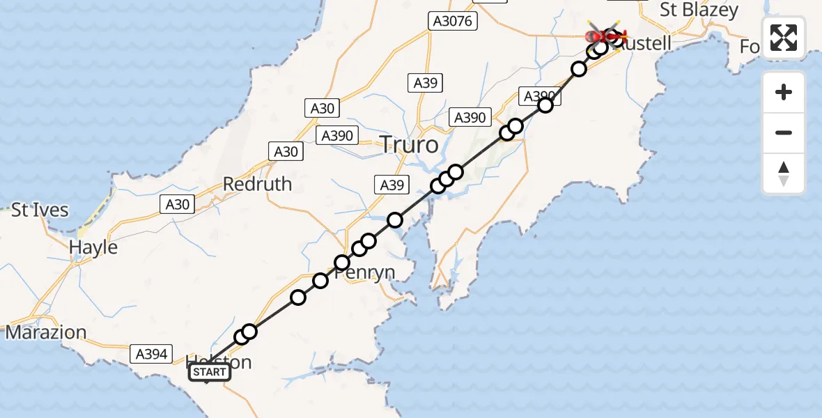
On Saturday, 28 February 2026 at 11:58, a Air Ambulance Helicopter departed from Helston to Trewoon. It was the Air Ambulance Helicopter with registration number G-CRWL. The flight lasted 15 minutes. During that period, the aircraft travelled 31 miles at an average speed of 122 miles per hour at a maximum altitude of 1225 feet.
Helicopter: G-CRWL
The helicopter G-CRWL is used as a air ambulance helicopter. The main purpose of this aircraft is to transport a Mobile Medical Team to an incident as quickly as possible, enabling the trauma doctor to provide immediate first aid on site. The aircraft is flying this flight as Air Ambulance Helicopter.
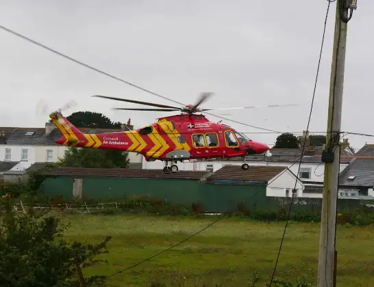
Photo: Pete Cruse
31 miles
1225 feet
122 mph
16 minutes
11:58
12:13

Route
Westbridge Road, 12:13
Trewoon12:12
St. Austell12:11
Trewoon12:10
St. Stephen-in-Brannel12:10
Sticker12:09
Grampound12:08
Probus12:07
Tregony with Cuby12:07
St. Michael Penkevil12:06
Malpas12:06
Truro River12:05
Feock12:04
Mylor Bridge12:04
Penryn12:04
Tremough12:03
Mabe Burnthouse12:03
Rame12:02
Seworgan12:01
Wendron12:01
Porthleven Road, 11:58
Live flights
Today
Flights Trewoon
Flights Helston
Helicopter flights on your website?
You can easily display helicopter flights on your own website. Use the embed code.
