Air Ambulance Helicopter to Cheddar, Silver Street
Saturday, 28 February 2026 | 8:56 | From Henstridge Airfield
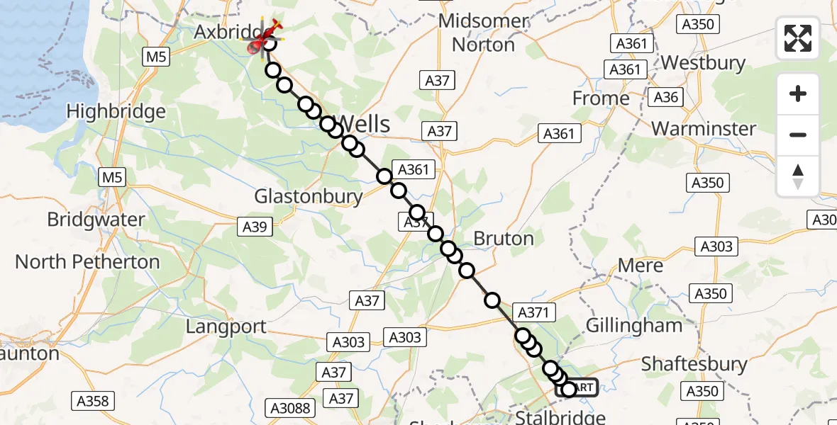
On Saturday, 28 February 2026 at 8:56, a Air Ambulance Helicopter departed from Henstridge Airfield to Cheddar. It was the Air Ambulance Helicopter with registration number G-DSAA. The flight lasted 17 minutes. During that period, the aircraft travelled 31 miles at an average speed of 113 miles per hour at a maximum altitude of 1250 feet.
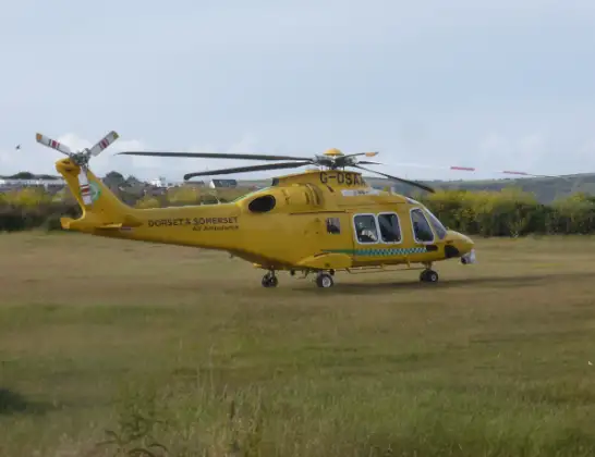
Helicopter: G-DSAA
The helicopter G-DSAA is used as a air ambulance helicopter. The main purpose of this aircraft is to transport a Mobile Medical Team to an incident as quickly as possible, enabling the trauma doctor to provide immediate first aid on site. The aircraft is flying this flight as Air Ambulance Helicopter.
Photo: Andrew Bone
32 miles
1250 feet
113 mph
17 minutes
08:56
09:13

Route
Silver Street, 09:13
Cheddar09:09
Nyland09:09
Draycott09:08
Westbury-sub-Mendip09:07
Easton09:07
Wookey09:07
Haybridge09:06
Coxley09:06
St Cuthbert Out09:06
North Wootton09:05
Pilton09:04
East Pennard09:03
Ditcheat09:03
Alhampton09:02
Ansford09:02
Castle Cary09:01
Yarlington09:00
Holton08:59
South Cheriton08:59
Horsington08:59
Templecombe08:58
Henstridge08:58
Kington Magna08:57
Shaftesbury Road, 08:57
Henstridge08:57
Henstridge Airfield, Templecombe, Somerset08:56
Today
Flights Cheddar
Air Ambulance Helicopter to Henstridge Airfield10 May 14:02
Air Ambulance Helicopter to Cheddar10 May 13:23
Police Helicopter to Almondsbury Helicopter Base25 Apr 16:38
Police Helicopter to Cheddar, Warrens Hill Road25 Apr 15:35
Air Ambulance Helicopter to Henstridge Airfield12 Apr 13:57
Helicopter flights on your website?
You can easily display helicopter flights on your own website. Use the embed code.
