Police Helicopter to MOD St Athan
Saturday, 28 February 2026 | 1:05 | From Bristol
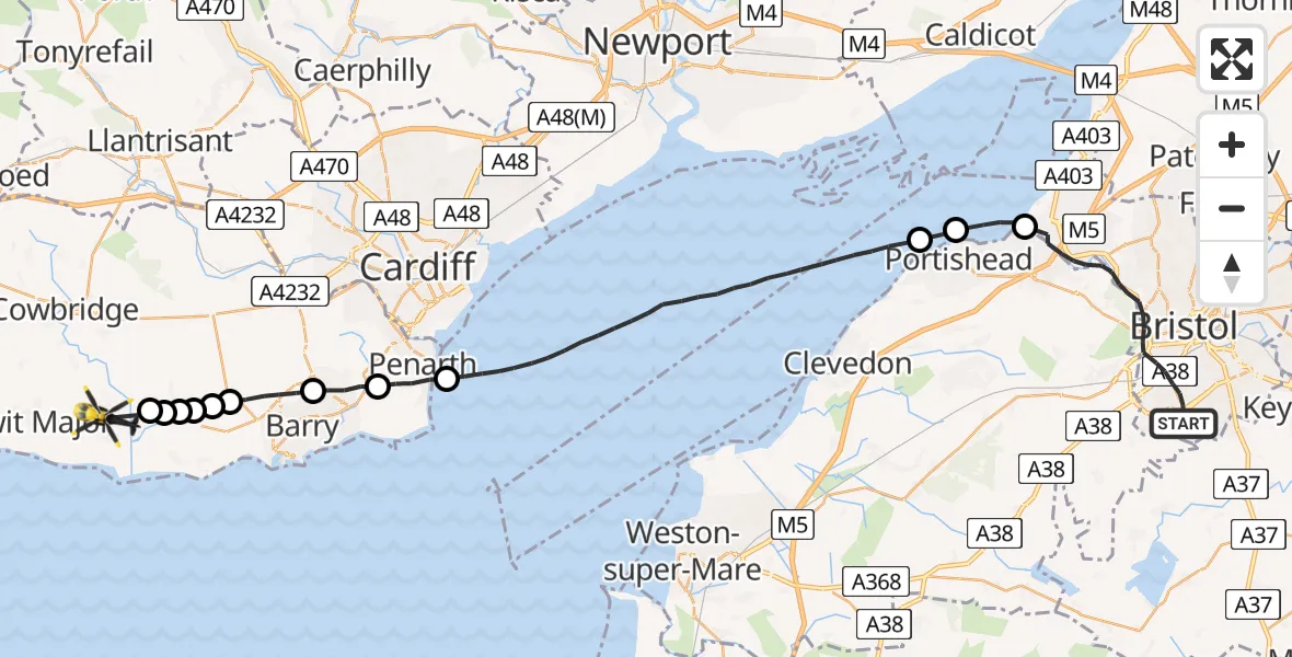
On Saturday, 28 February 2026 at 1:05, a Police Helicopter departed from Bristol to MOD St Athan. It was the Police Helicopter with registration number G-NWOI. The flight lasted 24 minutes. During that period, the aircraft travelled 44 miles at an average speed of 109 miles per hour at a maximum altitude of 1375 feet.

Helicopter: G-NWOI
The helicopter G-NWOI is used by the British police. The helicopter is deployed in pursuits, missing persons cases and other incidents where a helicopter provides added value.
Photo: Alec Wilson
44 miles
1375 feet
109 mph
25 minutes
01:05
01:29

Route
MOD St Athan, St Athan, Vale of Glamorgan01:29
Llancarfan01:29
Penmark01:28
Llancarfan01:28
Penmark01:28
Llancarfan01:28
Dyffryn01:27
Barry01:26
Dinas Powys01:25
Penarth01:24
Bristol Channel01:17
Portishead01:17
Pill and Easton-in-Gordano01:16
Wroughton Drive, West of England01:05
Live flights
Today
Flights Bristol
Police Helicopter to Bristol, Diana Gardens14 Jul 00:58
Police Helicopter to Bristol, Oaktree Crescent10 Jul 12:36
Police Helicopter to Bristol, Stoke Lane9 Jul 20:52
Helicopter flights on your website?
You can easily display helicopter flights on your own website. Use the embed code.
