Air Ambulance Helicopter to YAA Nostell Helicopter Port
Friday, 27 February 2026 | 18:52 | From Kirkburton
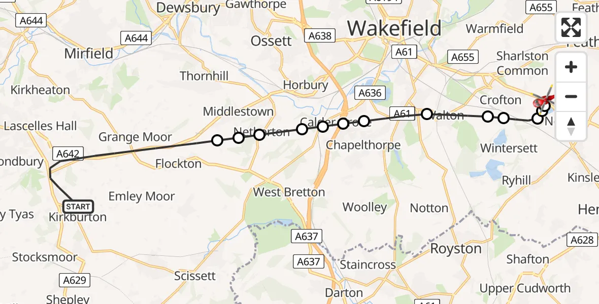
On Friday, 27 February 2026 at 18:52, a Air Ambulance Helicopter departed from Kirkburton to YAA Nostell Helicopter Port. It was the Air Ambulance Helicopter with registration number G-YORX. The flight lasted 12 minutes. During that period, the aircraft travelled 15 miles at an average speed of 74 miles per hour at a maximum altitude of 1925 feet.
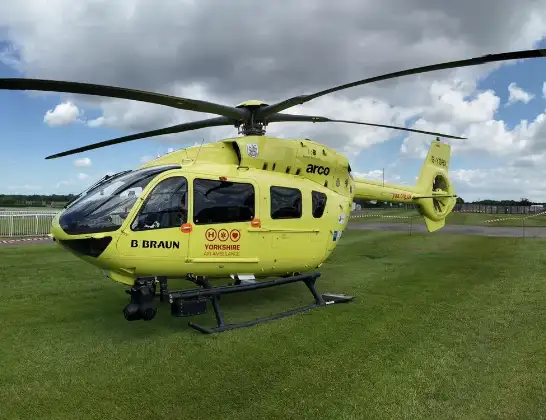
Helicopter: G-YORX
The helicopter G-YORX is used as a air ambulance helicopter. The main purpose of this aircraft is to transport a Mobile Medical Team to an incident as quickly as possible, enabling the trauma doctor to provide immediate first aid on site. The aircraft is flying this flight as Air Ambulance Helicopter.
Photo: Arollin96227
16 miles
1925 feet
74 mph
13 minutes
18:52
19:04

Route
YAA Nostell Helicopter Port, Foulby, Nostell, Yorkshire19:04
YAA Nostell Helicopter Port, Foulby, Nostell, Yorkshire19:04
YAA Nostell Helicopter Port, Foulby, Nostell, Yorkshire19:02
Foulby, Wakefield19:02
Nostell, Wakefield19:02
New Crofton, Wakefield19:01
Crofton, Wakefield19:01
Walton, Wakefield19:00
Kettlethorpe, Wakefield18:59
Calder Grove, Wakefield18:59
Great Cliff, Wakefield18:59
Horbury Bridge, Wakefield18:59
Netherton, Wakefield18:58
Middlestown, Wakefield18:58
Overton, Wakefield18:58
Burton Acres Lane, Kirklees18:54
Burton Acres Lane, Kirklees18:53
Burton Acres Lane, Kirklees18:53
Kirkburton, Kirklees18:52
Live flights
Police Helicopter on its way from Whitecraig27 Feb 23:19
Police Helicopter on its way from Salfords27 Feb 22:18
Today
Police Helicopter to Elphinstone, B641427 Feb 22:20
Police Helicopter to Bristol, Coniston Road27 Feb 22:14
Police Helicopter to East Ardsley, Stoney Lane27 Feb 21:09
Police Helicopter to Manchester Barton Aerodrome27 Feb 20:59
Police Helicopter to Newmilns27 Feb 20:50
Flights Kirkburton
Helicopter flights on your website?
You can easily display helicopter flights on your own website. Use the embed code.
