Air Ambulance Helicopter to Bristol, Bishop Manor Road
Friday, 27 February 2026 | 18:03 | From Henstridge Airfield
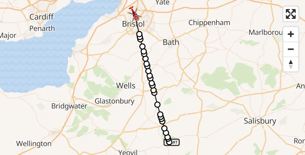
On Friday, 27 February 2026 at 18:03, a Air Ambulance Helicopter departed from Henstridge Airfield to Bristol. It was the Air Ambulance Helicopter with registration number G-DSAA. The flight lasted 16 minutes. During that period, the aircraft travelled 38 miles at an average speed of 142 miles per hour at a maximum altitude of 1525 feet.
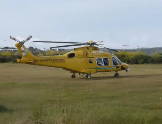
Helicopter: G-DSAA
The helicopter G-DSAA is used as a air ambulance helicopter. The main purpose of this aircraft is to transport a Mobile Medical Team to an incident as quickly as possible, enabling the trauma doctor to provide immediate first aid on site. The aircraft is flying this flight as Air Ambulance Helicopter.
Photo: Andrew Bone
38 miles
1525 feet
142 mph
16 minutes
18:03
18:19

Route
Bishop Manor Road, West of England18:19
Bristol, West of England18:15
Whitchurch, West of England18:15
Norton Malreward, West of England18:14
Pensford, West of England18:14
Chelwood, West of England18:13
Clutton, West of England18:13
High Littleton, West of England18:12
Farrington Gurney, West of England18:12
Clapton18:12
Chilcompton18:11
Stratton on the Fosse18:11
Holcombe18:10
Stoke St. Michael18:10
Downhead18:10
Cranmore18:09
Wanstrow18:09
Batcombe18:08
Bruton18:07
Stoney Stoke18:06
Wincanton18:06
Stoney Stoke18:06
Wincanton18:05
Horsington18:05
Abbas and Templecombe18:04
Kington Magna18:04
Henstridge18:03
Henstridge Airfield, Templecombe, Somerset18:03
Today
Police Helicopter to Falkirk02:12:08
Flights Bristol
Police Helicopter to Bristol, Diana Gardens14 Jul 00:58
Police Helicopter to Bristol, Oaktree Crescent10 Jul 12:36
Police Helicopter to Bristol, Stoke Lane9 Jul 20:52
Helicopter flights on your website?
You can easily display helicopter flights on your own website. Use the embed code.
