Coastguard Helicopter to Struan - An Sruthan, B885
Friday, 27 February 2026 | 15:34 | From Kingsburgh - Cinnseaborg

On Friday, 27 February 2026 at 15:34, a Coastguard Helicopter departed from Kingsburgh - Cinnseaborg to Struan - An Sruthan. It was the Coastguard Helicopter with registration number G-MCGI. The flight lasted 3 minutes. During that period, the aircraft travelled 8 miles at an average speed of 165 miles per hour at a maximum altitude of 1600 feet.
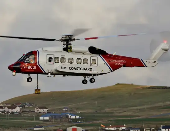
Helicopter: G-MCGI
The helicopter G-MCGI is used by the British Coastguard. The helicopter is deployed in search and rescue operations at sea, rescue operations involving ships or drilling platforms, patrols to prevent smuggling or piracy, environmental monitoring and disaster relief support.
Photo: CG Rescue G-MCGI MG 0869.jpg by Ronnie Robertson Licensed under CC BY-SA 2.0 Source: https://commons.wikimedia.org/wiki/File:CG_Rescue_G-MCGI_MG_0869.jpg
9 miles
1600 feet
165 mph
4 minutes
15:34
15:37

Route
B885, 15:37
Bernisdale - Beàrnasdal15:35
Treaslane - Triaslann15:34
Kingsburgh Road, 15:34
Live flights
Police Helicopter on its way from MOD St Athan15 Jul 23:53
Police Helicopter on its way from Wrenthorpe15 Jul 23:36
Today
Police Helicopter to Glasgow, Renfrew Road15 Jul 23:45
Police Helicopter to Manchester Barton Aerodrome15 Jul 23:33
Police Helicopter to Renfrewshire15 Jul 23:32
Air Ambulance Helicopter to Southampton Airport15 Jul 23:30
Police Helicopter to Coopersale, Epping Road15 Jul 23:07
Police Helicopter to Largs, Lane 115 Jul 23:02
Helicopter flights on your website?
You can easily display helicopter flights on your own website. Use the embed code.
